Much colder temperatures will move in for the end of the week

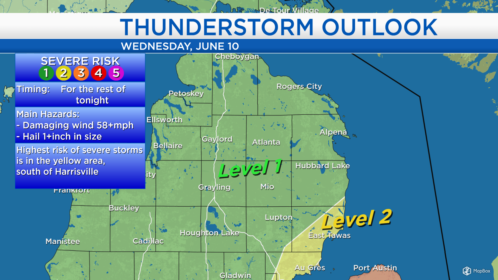
Ahead of an incoming cold front, temperatures got much warmer than ‘normal’ for mid-June. Also, dew points were close to 70 degrees indicating a very sultry air mass. Strong thunderstorms moved through Northeast Michigan this afternoon. From 1:50-2:45 p.m., Severe Thunderstorm Warnings were previously issued for Iosco County, and Tawas City received wind gusts at 66 mph. More showers and thunderstorms are developing to our west, so a chance of showers/storms remains in the forecast through this evening.
The updated “Level 2” severe storm risks have been confined to the southeast corner of Alcona County, a chunk of Iosco County and Arenac County. For the area shaded in yellow, damaging winds and hail will remain possible with any additional thunderstorms later this evening.
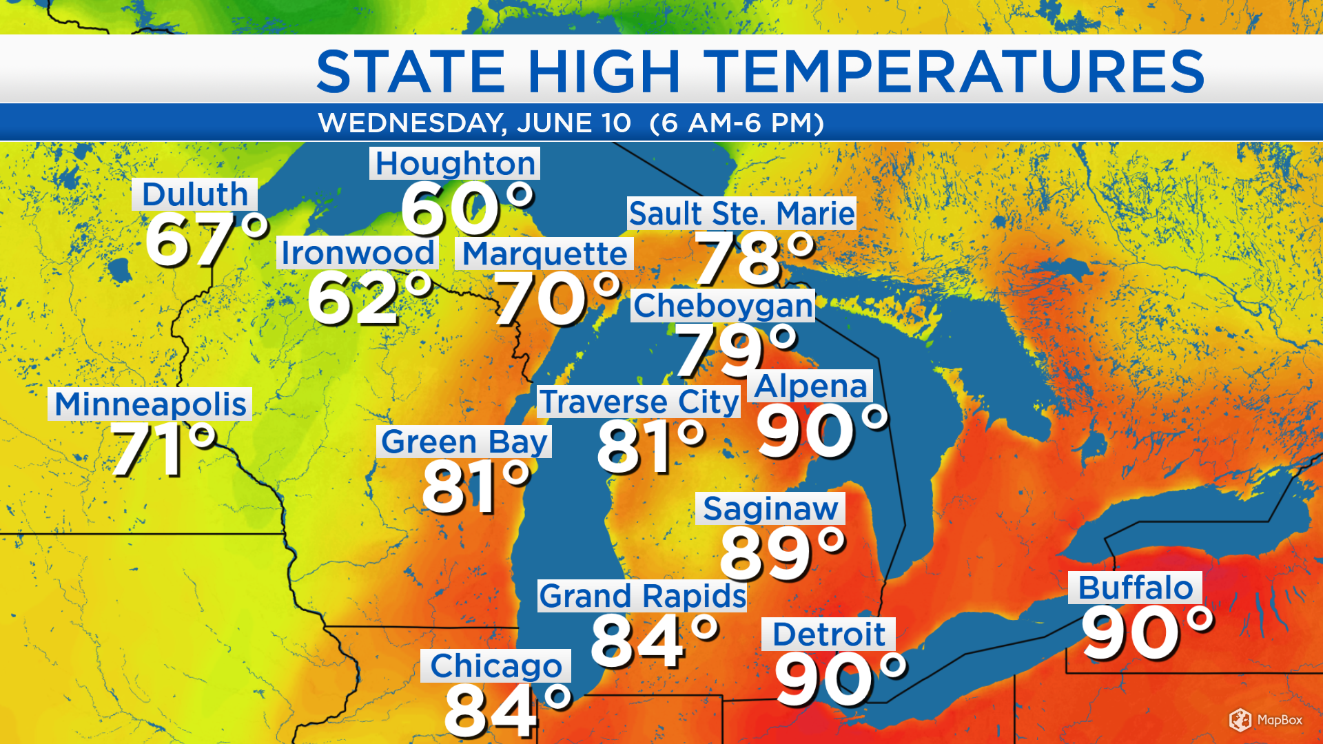
Temperatures today heated up to 90 degrees in Alpena, 89 degrees in Saginaw, and 84 degrees in Grand Rapids before thunderstorms moved in. A cold front will progress eastward through Michigan and bring colder temperatures beginning Thursday.
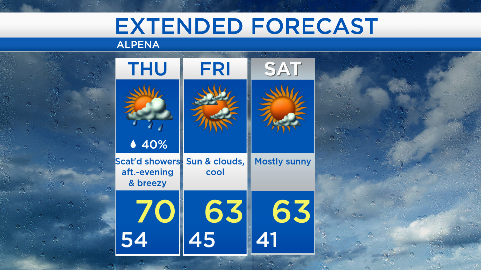
Low temperatures overnight will be around 54 degrees and storms will come to an end. Thursday morning will have a mix of sun and clouds with temperatures in the middle to upper 50s. A few scattered showers will be possible late-day with highs near 70 degrees. Winds will be blowing out of the west, about 20 mph.

Thursday will be breezy with highs around 70 degrees a chance of afternoon/evening showers. Friday will be even cooler with highs in the lower 60s and a mix of sun and clouds. Saturday will be mostly sunny with highs in the lower to middle 60s. Temperatures are forecast to go on a warming trend early next week. For the rest of Northeast Michigan’s weather forecast, watch the latest weather video by clicking the weather tab at the top of the page.