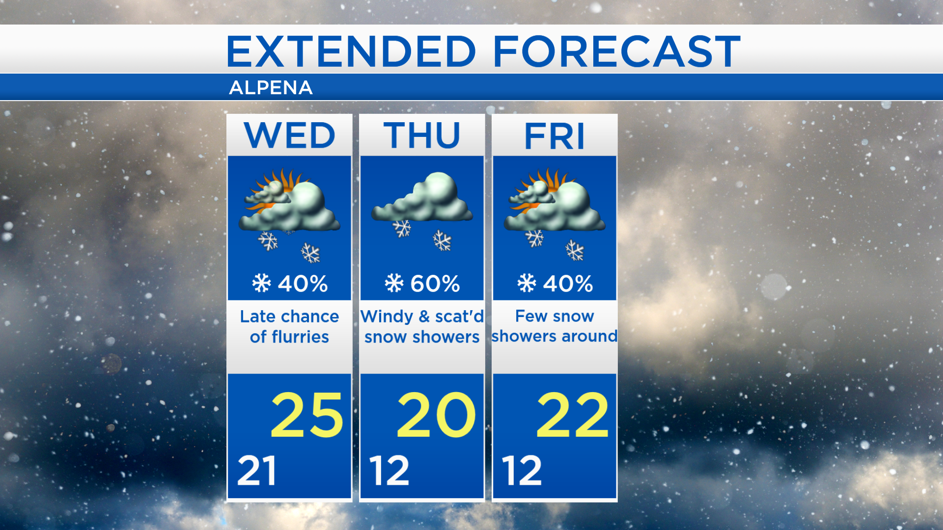
Much colder over the next few days — Wednesday, Thursday and Friday
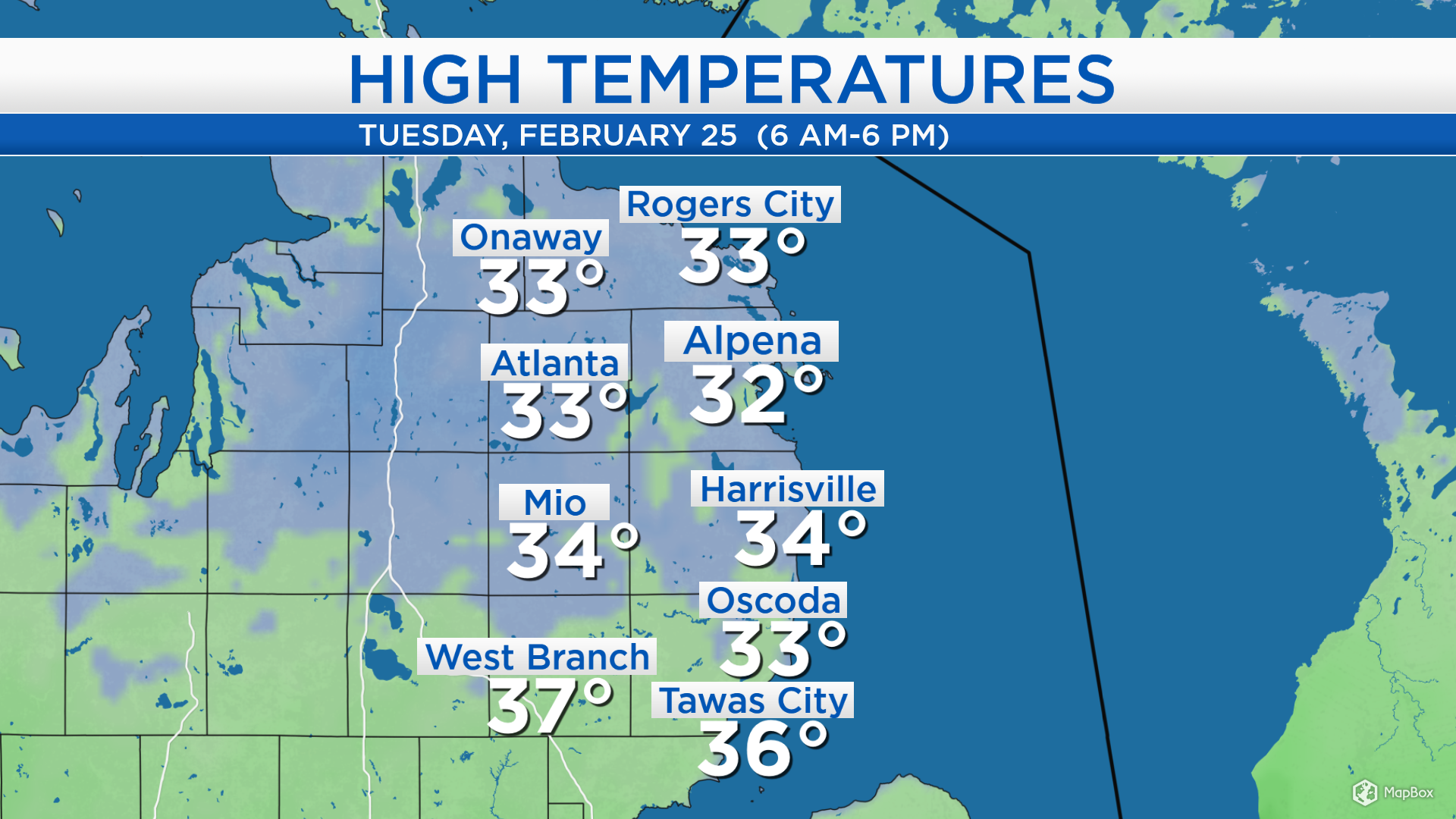
High temperatures today reached the lower to middle 30s across Northeast Michigan. The warm spot was West Branch with a high of 37 degrees, and Alpena was the cool spot at 32 degrees. Winds out of the northeast on Wednesday and northwest on Thursday will bring colder air to our area.
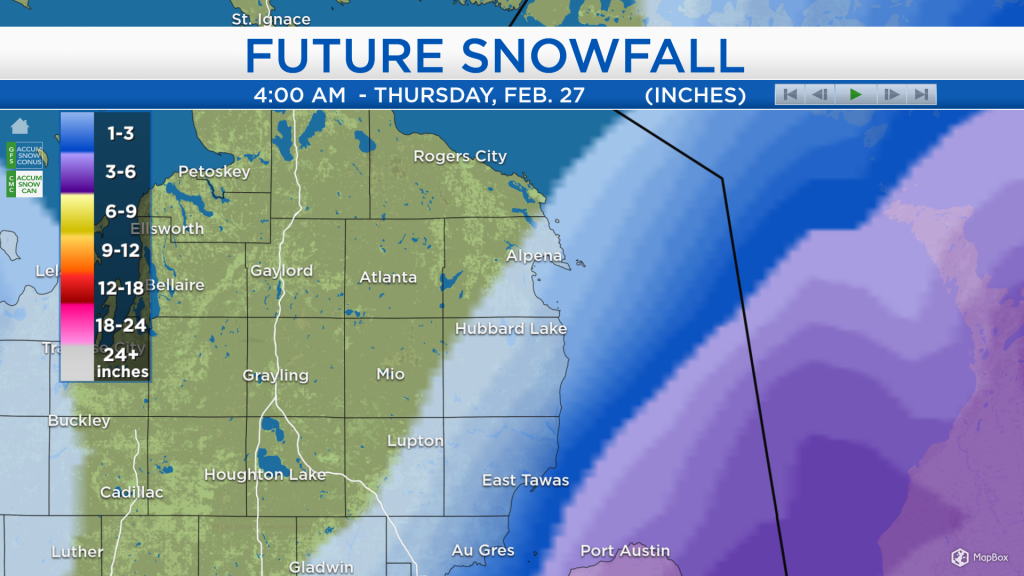
Snow and rain over southern Michigan, Indiana and Ohio will continue moving toward the northeast. This will get close to Lake Huron and give a chance of flurries mostly to areas closest to Lake Huron late Wednesday. Northwest winds on Thursday will generate lake effect snow, and scattered snow showers are expected in our area.
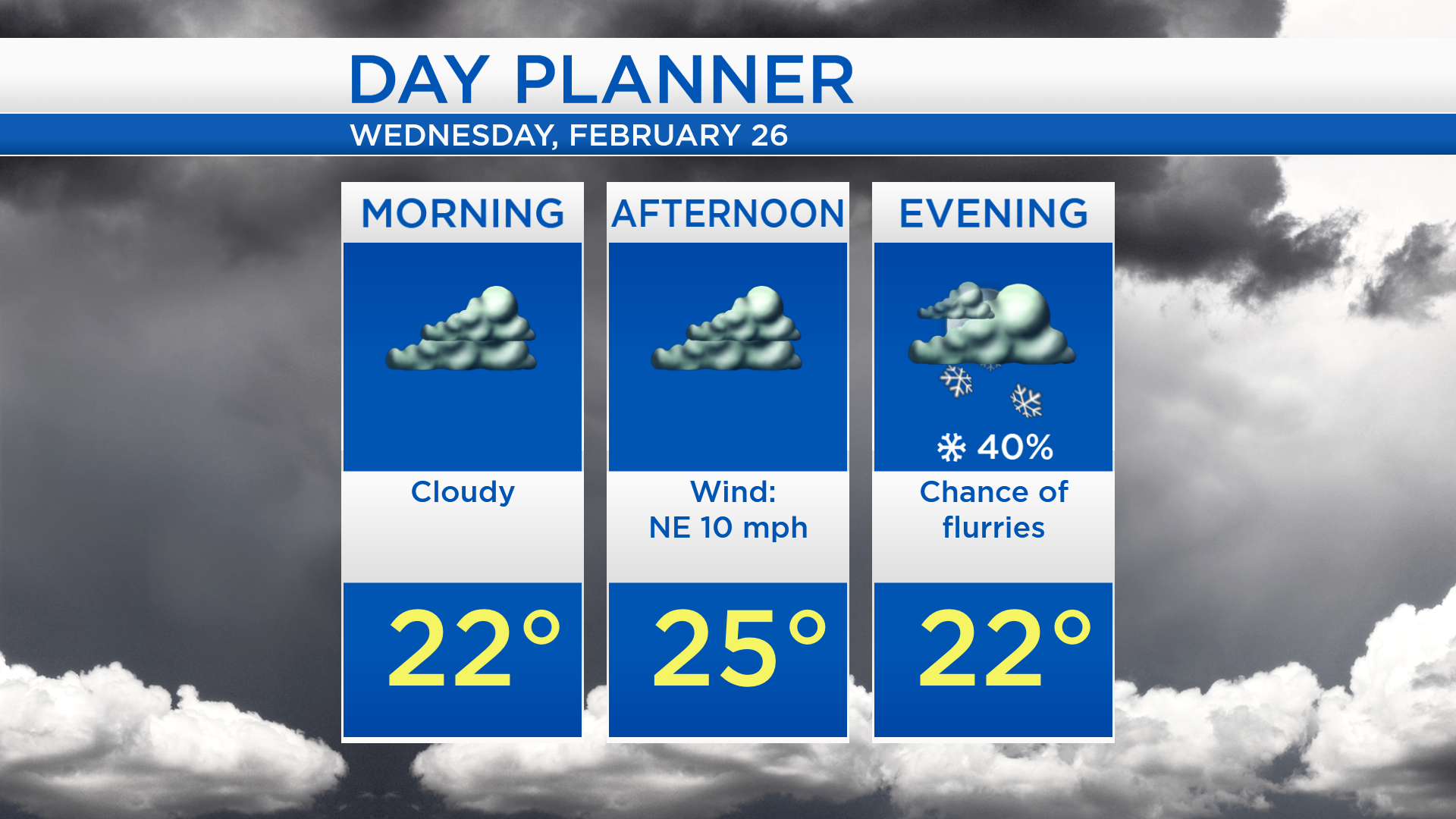
Low temperatures overnight will cool to about 21 degrees. Temperatures will not rise much tomorrow, getting to a high of 25 degrees. Cloudy skies will persist all day and winds will come from the northeast, about 10 mph. A few flurries will be possible in the evening.
“Future Snowfall” is shading the Alpena area in the lightest shades of blue, indicating low snowfall amounts through the predawn hours early Thursday. The chances of snow will be lower farther west of the Lake Huron shoreline.

Highs will reach the middle 20s on Wednesday. Thursday will be even colder and chances of snow showers will be a bit higher. Highs will reach about 20 degrees Thursday afternoon. A few snow showers are possible Friday, although the chances are lower. The weekend is looking to be brighter and milder, highs will be in the middle 20s Saturday and near 30 degrees Sunday. For the rest of Northeast Michigan’s weather forecast, watch the latest weather video by clicking the weather tab at the top of the page.