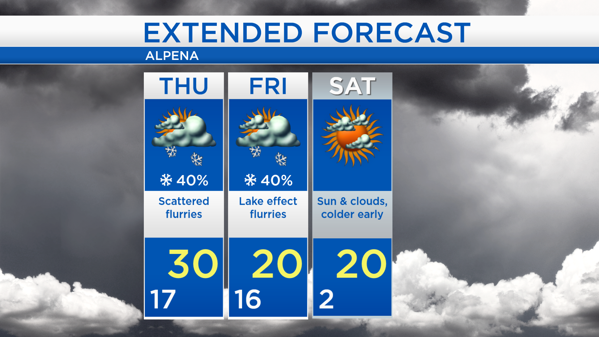
Mild Thursday; Chance of lake effect flurries Friday and colder late-week
A storm system centered over Mississippi is bringing a risk of severe storms to parts of the southeast, and snow from southern Michigan to Texas. This storm will bring snow to parts of Lower Michigan tonight and Thursday, but major snowfall amounts are expected to stay south of our area. In Northeast Michigan, flurries are possible Thursday morning and afternoon.
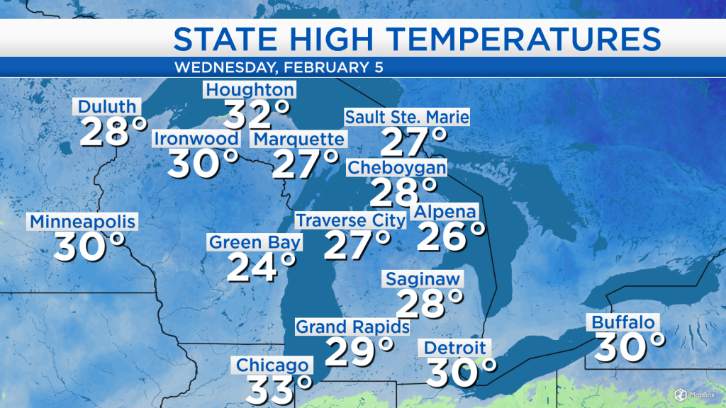
High temperatures today reached 26 degrees in Alpena, but at least the cloud cover thinned out and gave way to some breaks of sunshine. Chicago got up to 33 degrees and Minneapolis had a high of 30 degrees — milder temperatures are on the way for tomorrow.

Low temperatures overnight will be in the upper teens with cloudy skies. Scattered flurries are possible tomorrow morning and afternoon, but the higher chances of snow look to stay south of Alpena. High tempreatures will reach about 30 degrees and winds will be light, about 5 mph. Evening temperatures will cool to the middle 20s with cloudy skies.

On Friday, winds out of the north could generate lake effect flurries off of Lake Huron. The better chances of flurries will be in the morning and afternoon. Also, winds out of the north will bring colder air to our area.
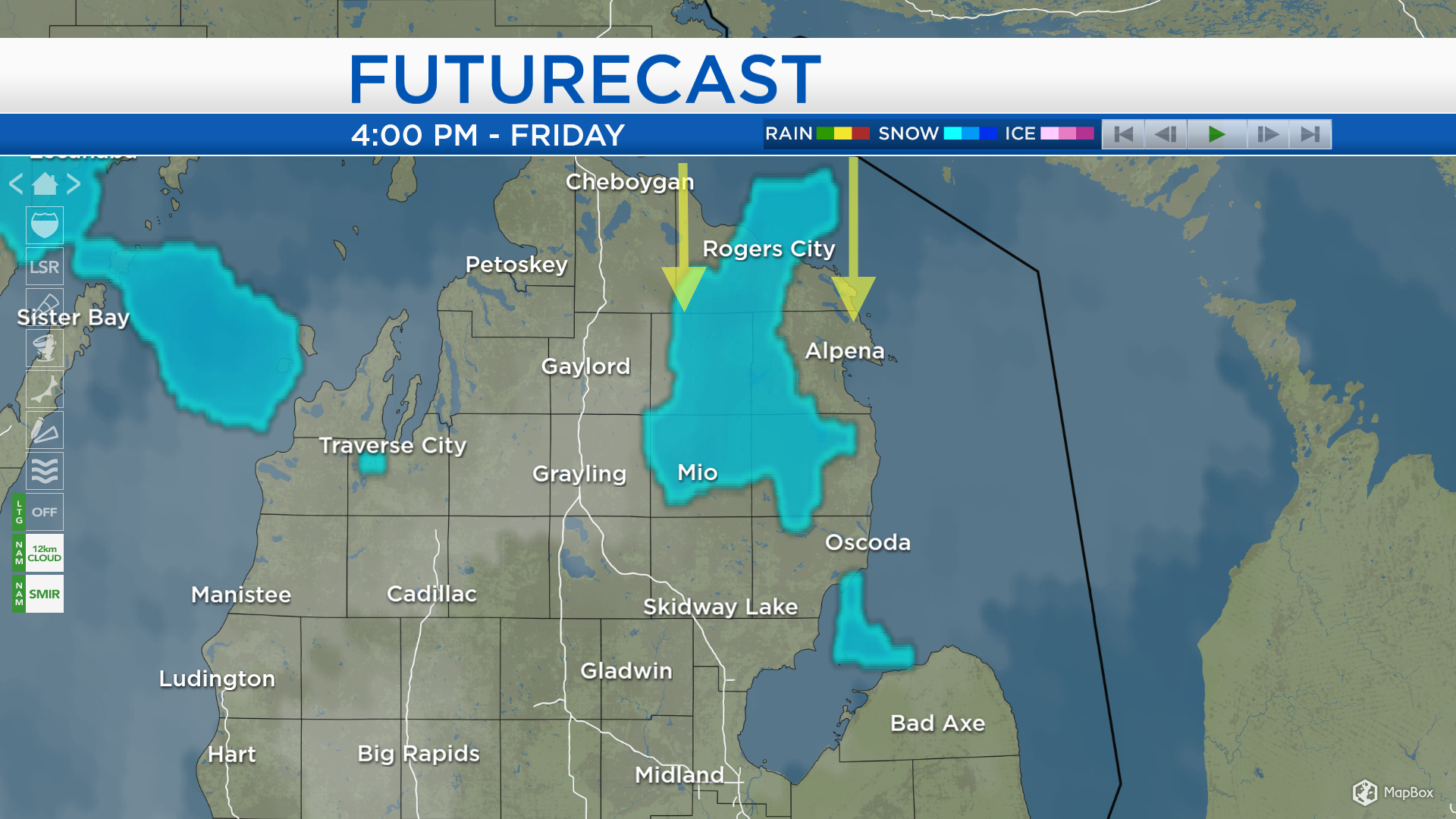
Scattered flurries are possible Thursday but amounts will be low. The chance of flurries will briefly reduce Thursday evening-nighttime. A chance of lake effect flurries will develop Friday morning and afternoon. Temperatures Friday will be noticeably colder, getting to highs around 20 degrees. Lows will drop to about 2 degrees early Saturday, a mix of sun and clouds is expected for the first part of the weekend. For the rest of Northeast Michigan’s weather forecast, watch the latest weather video by clicking the weather tab at the top of the page.