Light snow/mix Saturday, drier Sunday while temperatures remain warm
Light snow in the Upper Peninsula and Wisconsin will continue to progress east, ahead of a weak cold front. The cold front will not do much to cool down temperatures. Snow showers will move into Northeast Michigan early Saturday.
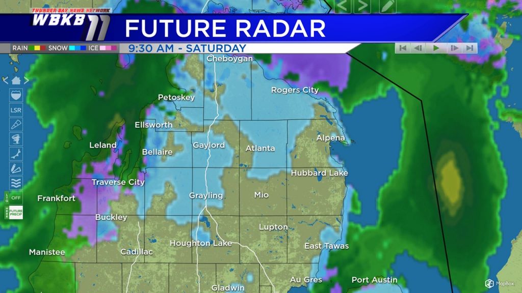
Future Radar shows snow showers moving into Northeast Michigan before daybreak, early Saturday. A rain/snow mix will be possible midday to early-afternoon with temperatures climbing several degrees above freezing. Drier conditions will settle in Saturday evening and remain through the rest of the weekend.
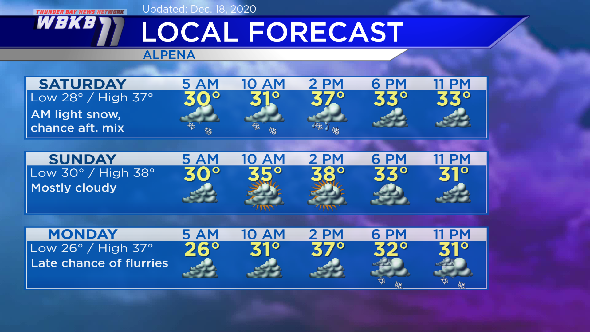
Saturday: A chance of light snow in the morning, rain/snow mix possible midday to early-afternoon. Early-morning temperatures will begin in the upper 20s to near 30 degrees. Afternoon highs will reach about 37 degrees. Evening temperatures will be in the lower 30s.
Sunday: Mostly cloudy, temperatures remain above normal. Predawn temperatures will be near 30 degrees. Afternoon highs will get up to 38 degrees. Evening temperatures will dip to the lower 30s.
Monday: Cloudy skies, a chance of flurries late. Early-morning temperatures will cool to the middle/upper 20s. Afternoon highs will climb to 37 degrees. Evening temperatures will be in the lower 30s.
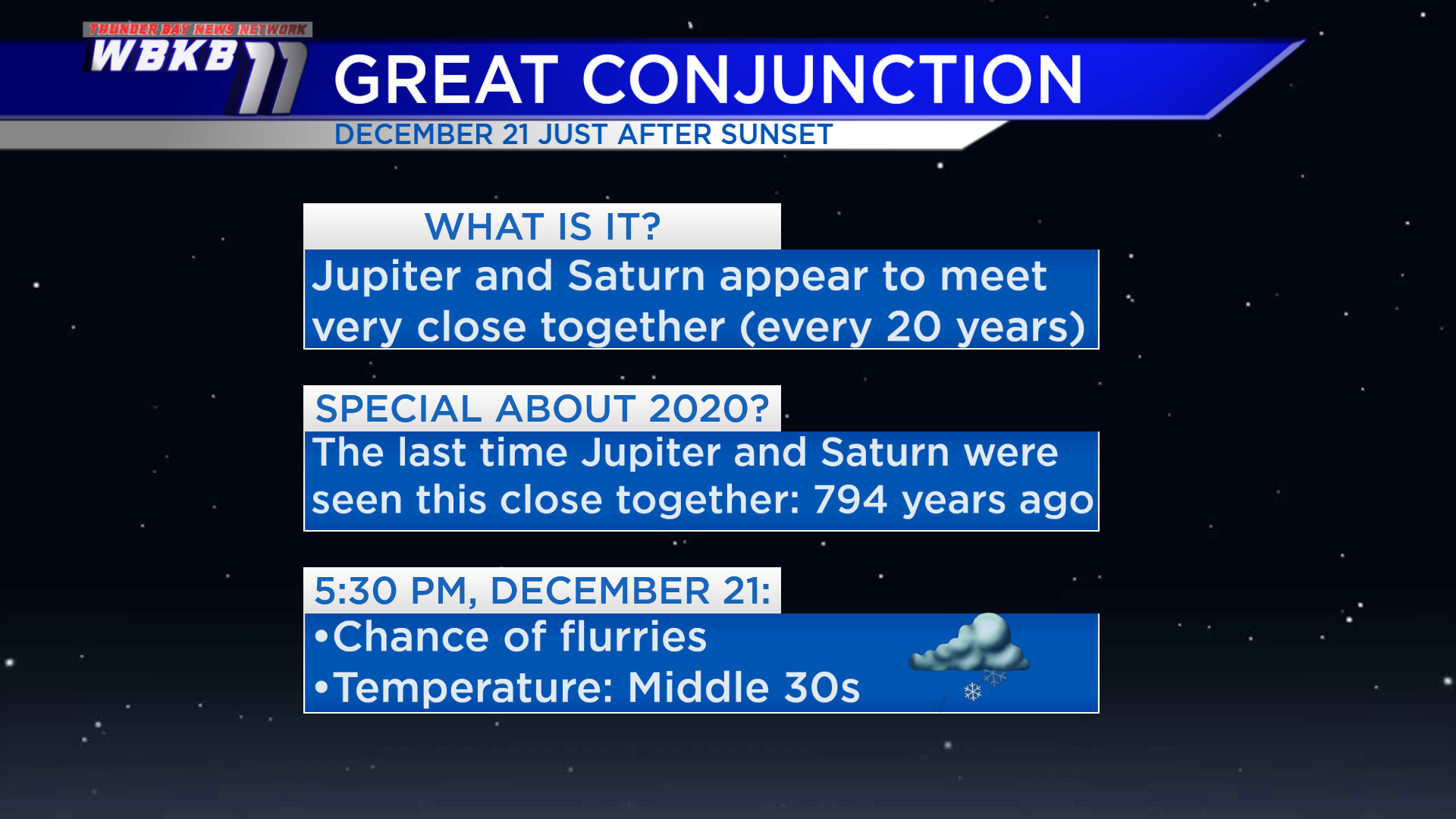
A Great Conjunction, when Jupiter and Saturn appear really close together, will take place Monday. The time to view it will be just after sunset, but locally we will have cloudy skies with a chance of flurries. Jupiter and Saturn will appear like one bright star in the southwestern sky. A Great Conjunction happens roughly every 20 years. This year, the proximity between Jupiter and Saturn will be the closest seen from Earth in nearly 800 years!
For the rest of Northeast Michigan’s weather forecast, watch the latest weather video by clicking the weather tab at the top of the page.


