Lake effect snow tonight; Wind chills below zero Wednesday
Winds out of the northwest crossing over Lake Michigan are generating lake effect snow. Snow showers will remain possible through Wednesday afternoon. These northwest winds are also bringing very cold air to Northern Michigan tonight through Wednesday night.
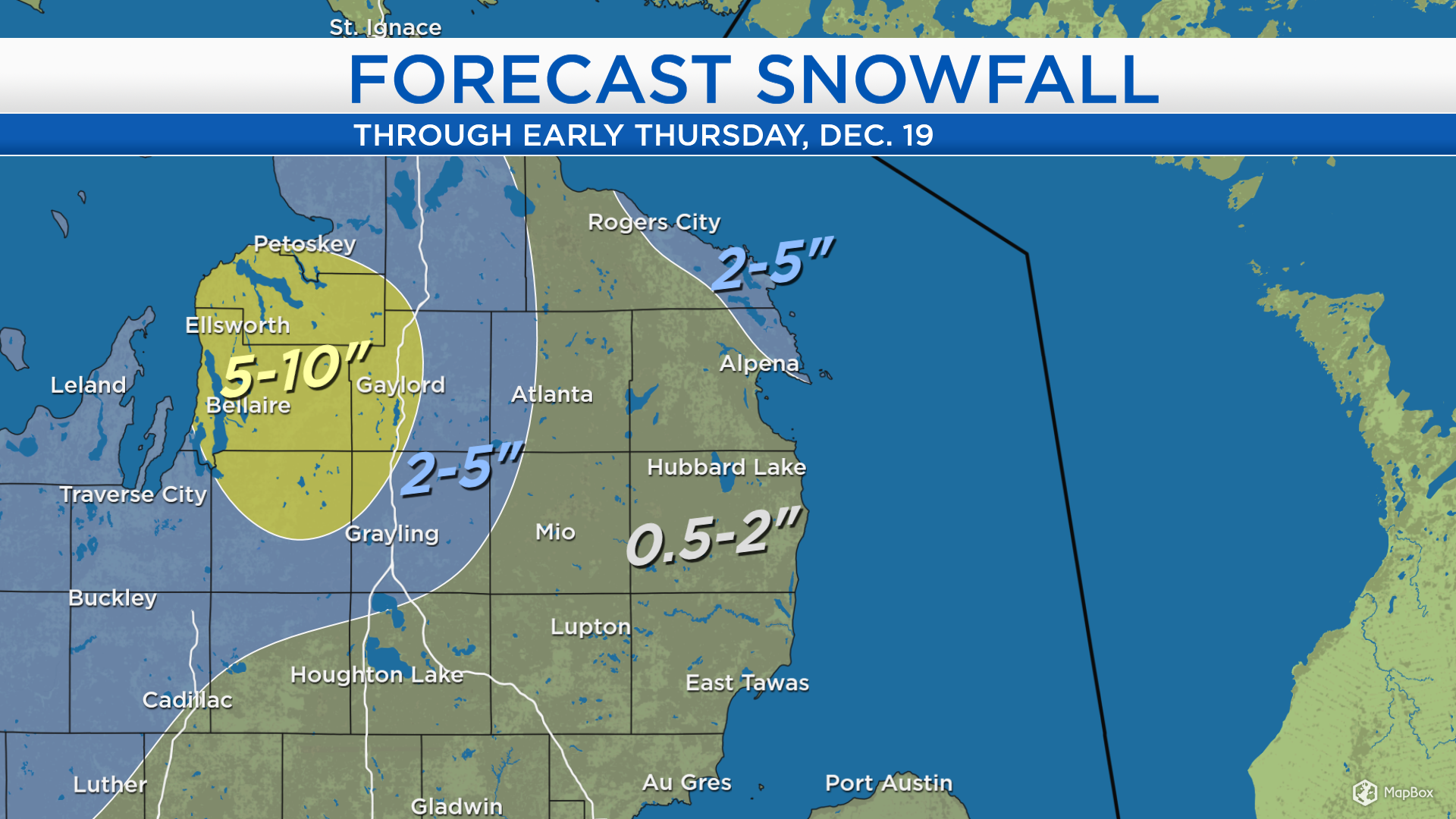
Total snowfall amounts will be 0.5-2 inches for most of Northeast Michigan. However, winds out of the northwest typically bring greater lake effect snow to eastern Presque Isle County and northeastern Alpena County. For the areas highlighted in blue, 2-5 inches of snow are possible. The greatest amounts of snow will stay to our west, resulting from Lake effect snow off of Lake Michigan. Areas from Kalkaska to Gaylord to Charlevoix are forecast to get 5-10 inches of snow, shown in yellow.
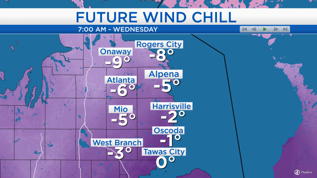
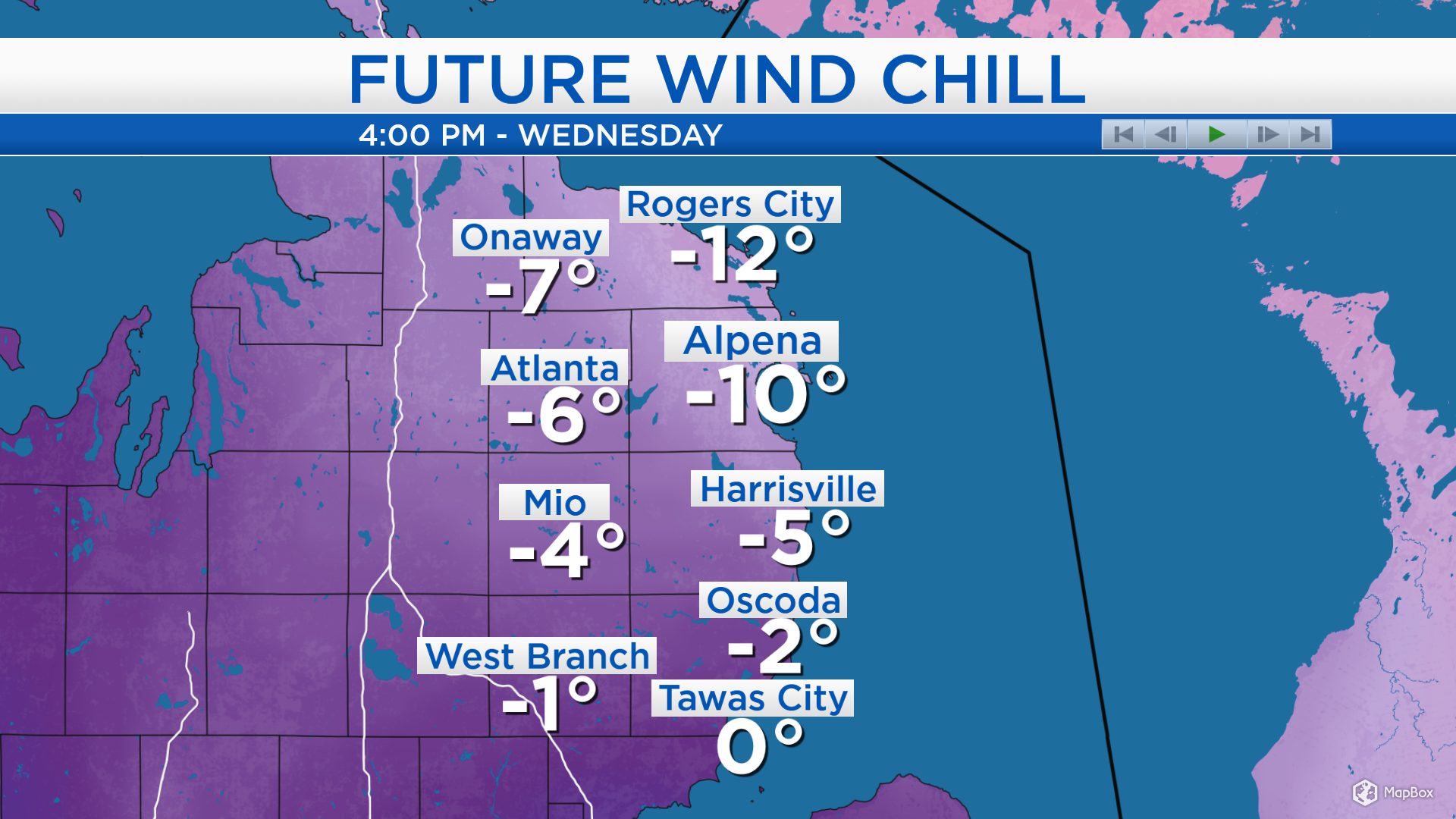
Wind chills will drop below zero early Wednesday, so definitely bundle up for these values. The wind chill numbers describe what it feels like onto exposed skin because of the combined effect of cold temperatures and stronger winds.

Winds will increase midday Wednesday, so wind chill values will not get any better for the afternoon. It will take until Thursday afternoon for winds to become lighter and temperatures to get warmer.
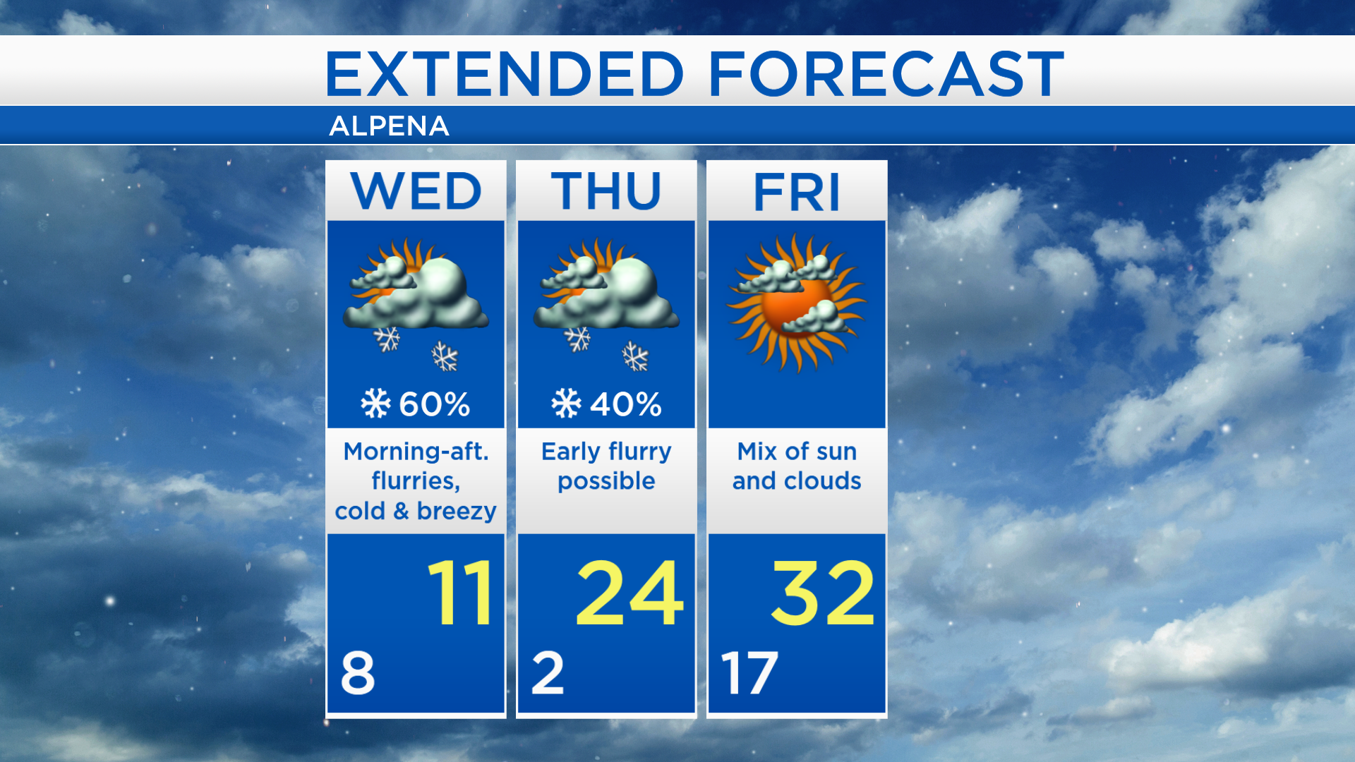
High temperatures will reach only 11 degrees on Wednesday. Thursday morning will also be very cold, starting with lows near 2 degrees and a few flurries will be possible early. Highs will reach 24 degrees Thursday afternoon with mostly cloudy skies. A mix of sun and clouds will settle in for Friday and temperatures will warm to the lower 30s. For the rest of Northeast Michigan’s weather forecast, watch the latest weather video by clicking the weather tab at the top of the page.