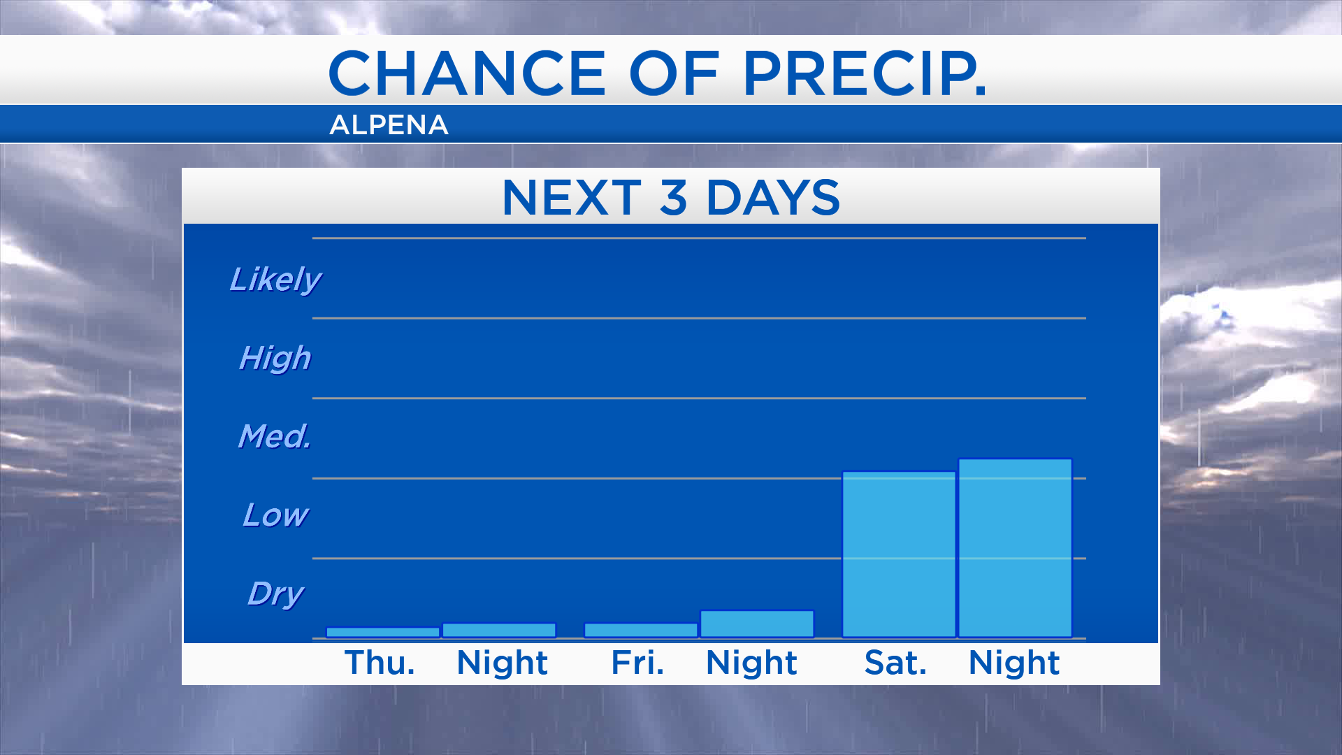
Increasing humidity later in the week
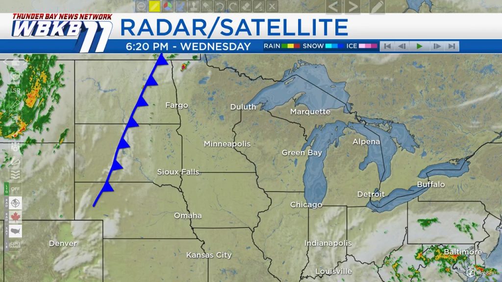
We have mainly clear skies over most of Michigan, it’s going to stay that way tonight and tomorrow. A slow-moving cold front is currently parked over North Dakota, South Dakota and Nebraska, and it is triggering an outbreak of thunderstorms this evening in those areas. The cold front will move eastward, and give chances of showers/thunderstorms to our area over the weekend.
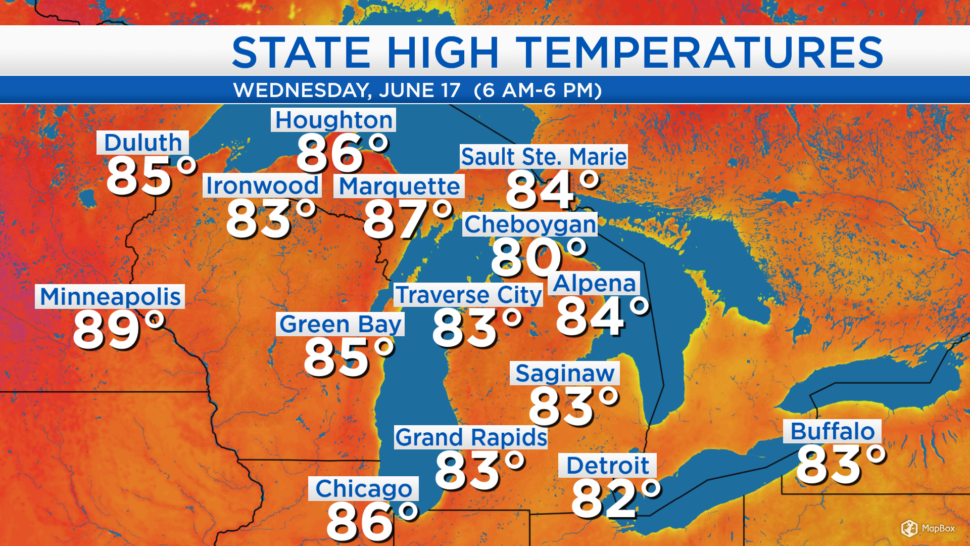
High temperatures today got up to 84 degrees in Alpena, 83 degrees in Saginaw and 86 degrees in Chicago. Highs in the upper 80s are forecast for areas away from the Lake Huron shoreline over the next couple of days.
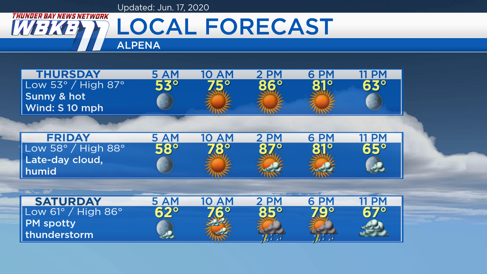
Thursday will be sunny, then Friday will have increasing clouds late in the day. A cold front in the Upper Plains and moving east will bring a medium chance of showers/thunderstorms Saturday.
Thursday: Sunny and hot. Temperatures will start with predawn lows near 53 degrees. Morning temperatures will climb to the middle 70s by 10 a.m. and afternoon highs will warm to about 87 degrees. Temperatures will still be close to 80 degrees at 6 p.m.
Friday: Increasing clouds late-day and more humid. The day will start with predawn lows in the upper 50s and clear skies early. By 10 a.m., temperatures will already be rising to the upper 70s. Afternoon highs will reach the upper 80s and higher humidity levels will be noticeable. Temperatures will be in the lower 80s around 6 p.m. with a mix of sun and clouds.
Saturday: Spotty thunderstorms possible in the afternoon-evening. Predawn temperatures will start in the lower 60s. Afternoon highs will reach about 86 degrees. Late-evening temperatures will be in the upper 60s even at 11 p.m.