
Incoming cold front will give way to colder temperatures early next week
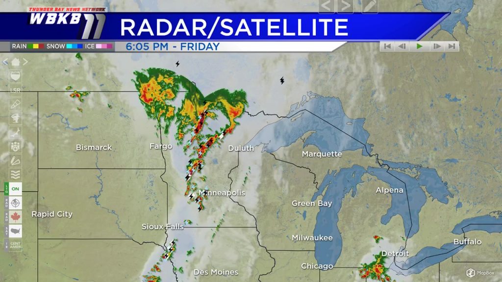
Friday night, we have mostly clear skies across Northern Michigan. An incoming cold front is producing a line of thunderstorms extending through Minnesota and Iowa. This cold front will move east and affect our area late Saturday to early Sunday.
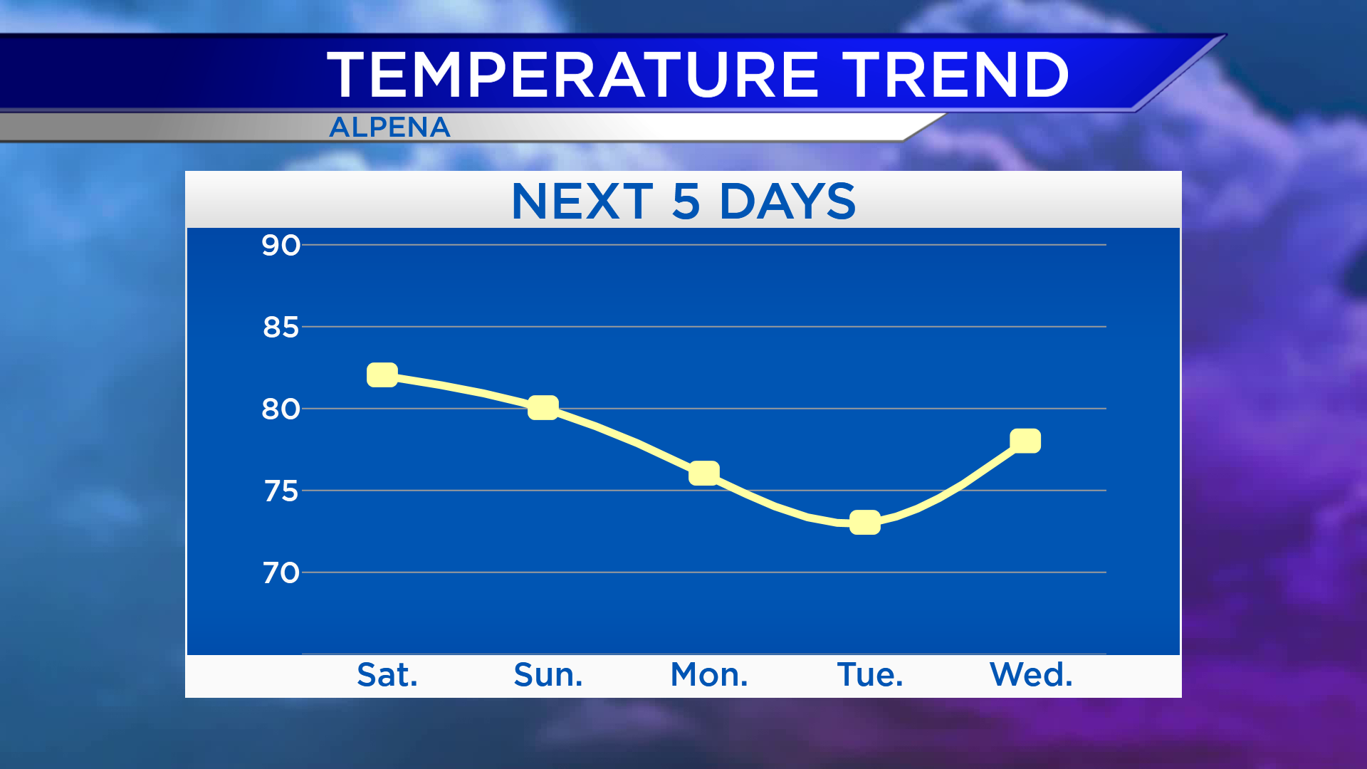
High temperatures Saturday afternoon will reach the lower 80s. On Sunday, highs will be close to 80 degrees. Following this weekend’s cold front, temperatures will become colder early next week. Highs will be in the middle 70s Monday afternoon and only in the lower 70s Tuesday.
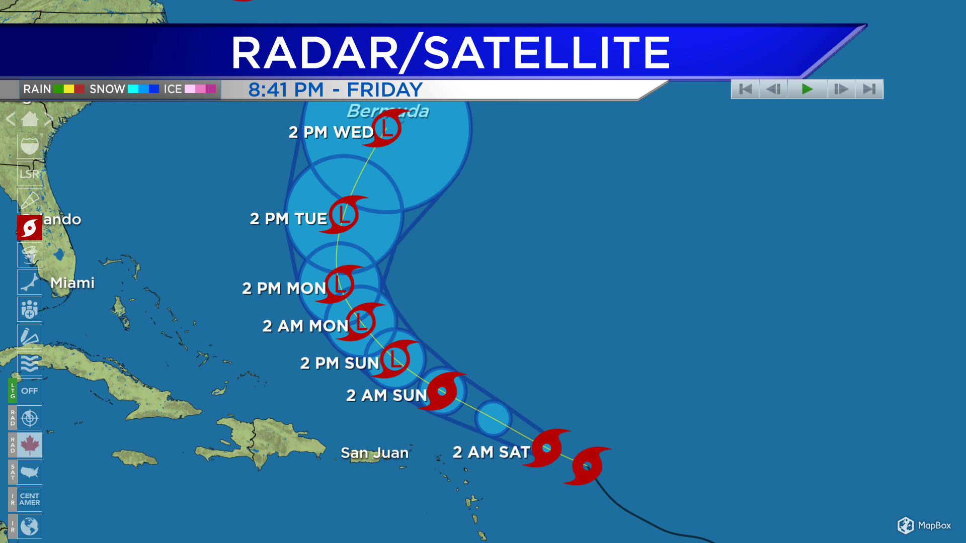
Tropical Storm Josephine is continuing to move toward the west-northwest and will pass well north of Puerto Rico this weekend. Late this weekend into early next week the tropical storm is forecast to weaken and become a post-tropical depression (a storm system with lower wind speeds and no longer tropical).
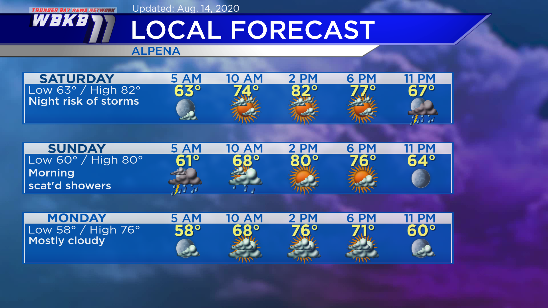
Saturday: A mix of sun and clouds, then a risk of thunderstorms will arrive at night. Predawn temperatures will be in the lower 60s. Late-morning temperatures will rise to the middle 70s. Afternoon highs will be near 82 degrees. Early-evening temperatures will be in the middle 70s.
Sunday: A risk of thunderstorms early, then clearing in the afternoon. Early-morning lows will be near 60 degrees. Temperatures will get into the upper 60s in the late-morning. Afternoon highs will reach about 80 degrees. Early-evening temperatures will be in the lower/middle 70s.
Monday: Mostly cloudy and cooler. Predawn lows will be in the upper 50s. Late-morning temperatures will climb to the upper 60s. Afternoon highs will only gt up to the middle 70s. Early-evening temperatures will be close to 70 degrees.
For the rest of Northeast Michigan’s weather forecast, watch the latest weather video by clicking the weather tab at the top of the page.


