Hot & humid through midweek; Scattered storms possible Tuesday afternoon
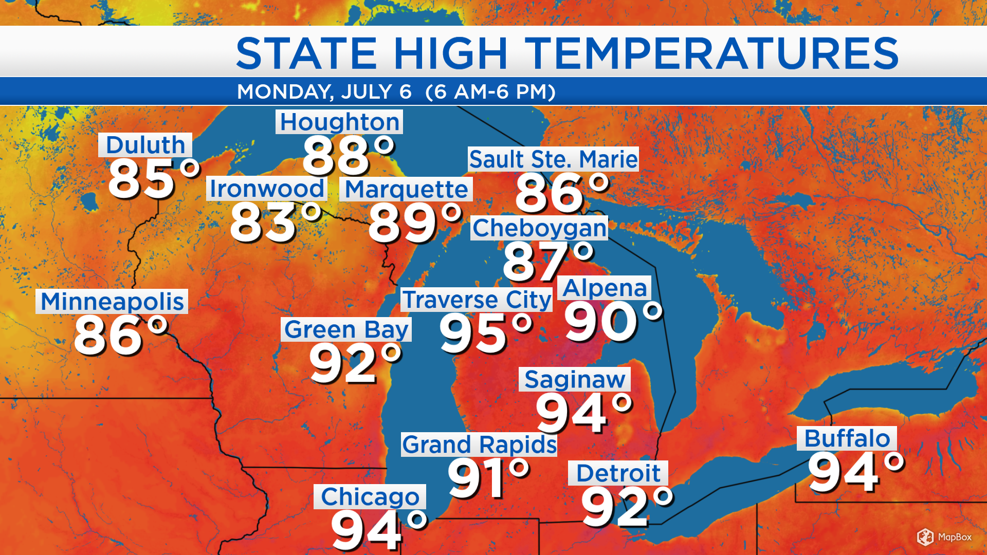
High temperatures today heated up to 90 degrees in Alpena, 94 degrees in Saginaw and 95 degrees in Traverse City. Temperatures will remain very warm throughout most of this week.
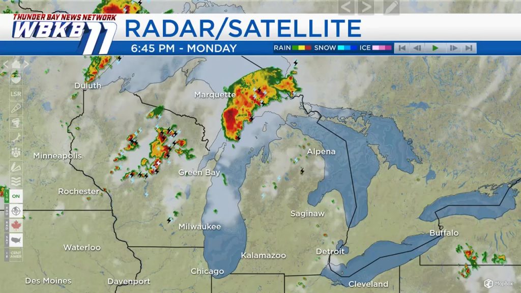
More moisture and instability have led to thunderstorms over the Upper Peninsula and Wisconsin today. A chance of thunderstorms will arrive in Northeast Michigan Tuesday midday and continue through the afternoon. Rain chances will become very low Tuesday night and Wednesday.
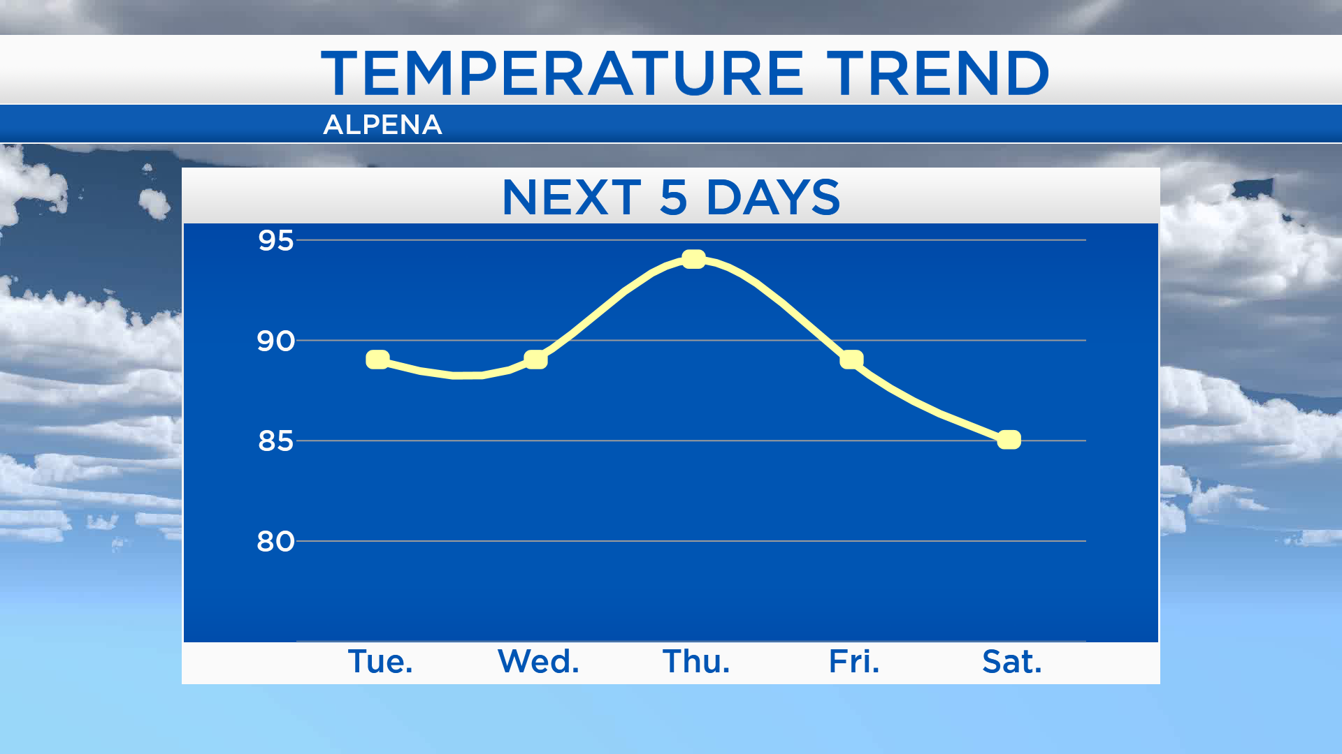
High temperatures will be in the upper 80s or near 90 degrees Tuesday and Wednesday. Brisk winds from the south will cause a further surge of heat and humidity into our area Thursday, and highs will likely soar to the middle 90s. A cold front will move in Friday, and highs will return to the upper 80s. After the cold front moves through Northern Michigan, temperatures will then become a little cooler over the weekend.
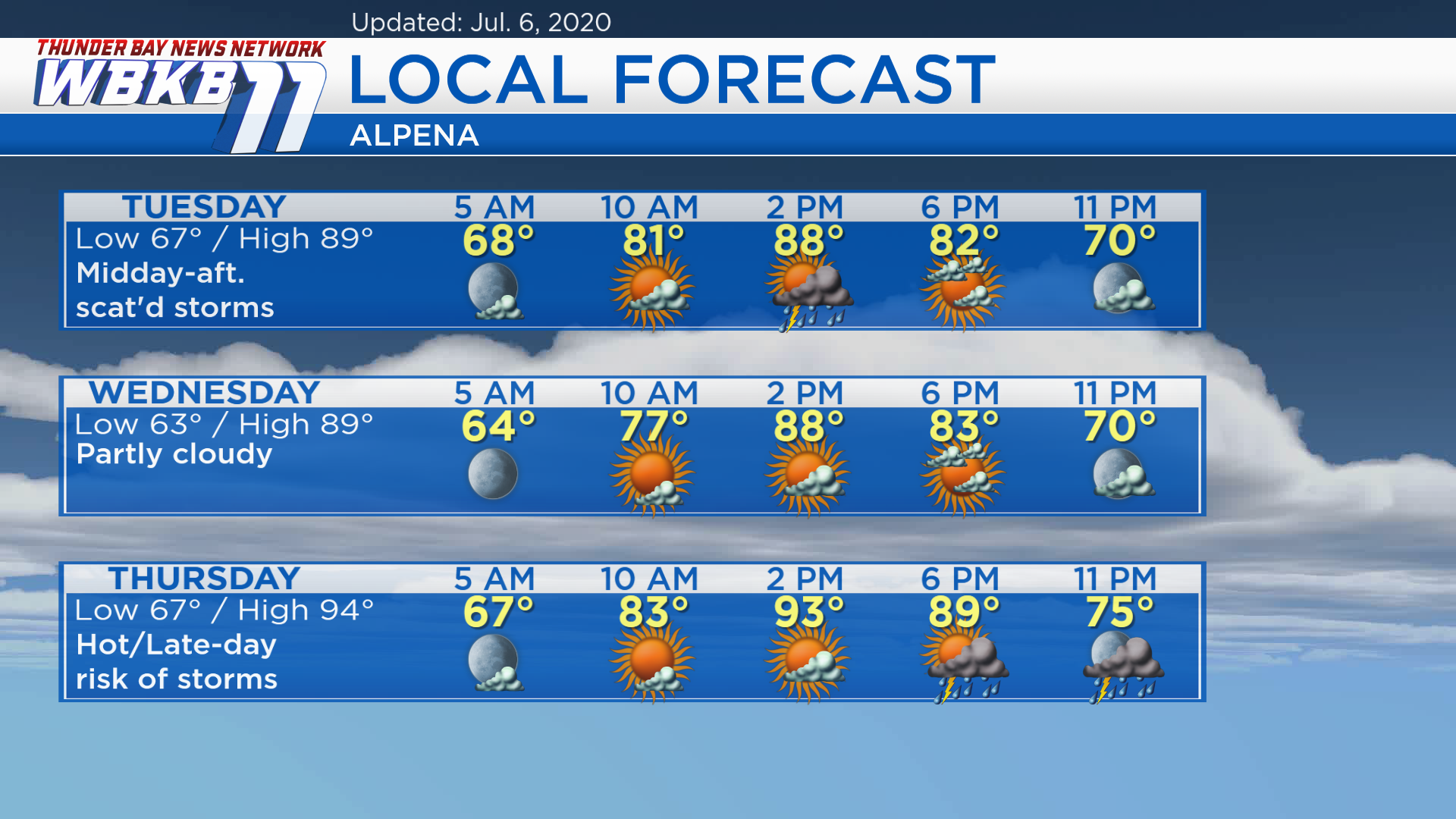
Tuesday: A mix of sun and clouds with a risk of thunderstorms midday-afternoon. Predawn temperatures will start in the upper 60s. By the late-morning, temperatures will rise to the lower 80s. Afternoon highs will reach about 89 degrees. Early-evening temperatures will be in the lower 80s.
Wednesday: Partly cloudy and warm. Predawn lows will be in the lower 60s. Temperatures will climb to the upper 70s in the late-morning. Afternoon highs will warm to about 89 degrees. Early-evening temperatures will be in the lower 80s.
Thursday: Very hot with increasing clouds then a late-day risk of thunderstorms. Predawn temperatures will be in the upper 60s. Temperatures will rise to the lower 80s by the late-morning. Afternoon highs will soar to about 94 degrees. Early-evening temperatures will remain quite toasty, in the middle to upper 80s.
For the rest of Northeast Michigan’s weather forecast, watch the latest weather video by clicking the weather tab at the top of the page.


