Hot and humid most of this week; Wettest Thursday
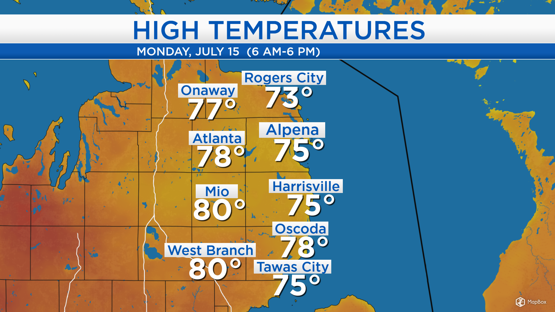
Temperatures today were suppressed by clouds and showers earlier this afternoon, so highs reached only the middle to upper 70s. Warmer temperatures are moving in tomorrow with lesser chances of showers.
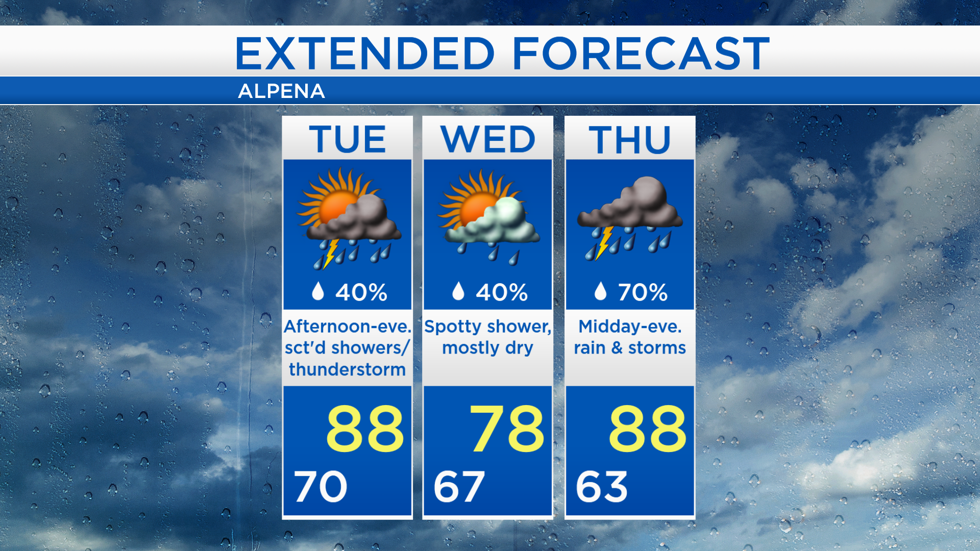
Instability over Northern Michigan will wane this evening, providing mostly — but not completely — dry conditions Tuesday and Wednesday. A more well-organized system originating in the Upper Plains will increase the chance of rain on Thursday.
Low temperatures tonight will cool only to 70 degrees, so it will remain warm and muggy. High temperatures are forecast to reach the upper 80s tomorrow, depending on the amount of afternoon sunshine. A low but still mentionable chance of showers and thunderstorms will arrive in the afternoon-evening.

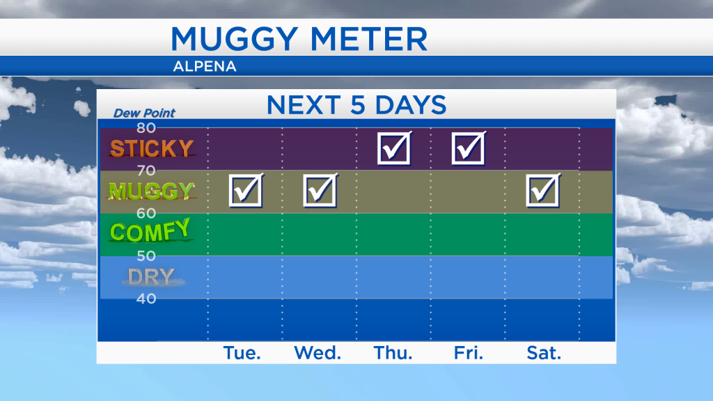
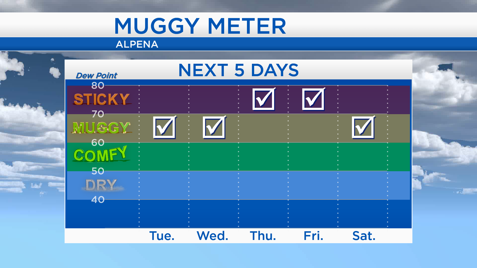
Dew point values will remain above the 60 degree threshold all week, signifying elevated humidity levels. Thursday and Friday will be the stickiest days, when dew point values will reach the 70s.
Tomorrow, a few scattered showers or thunderstorms are possible in the afternoon and evening. Most of Wednesday is looking dry even though a spotty shower cannot be ruled out. Light winds out of the east, off of Lake Huron, will keep temperatures cooler on Wednesday with highs in the upper 70s. The heat is on again Thursday with highs in the upper 80s and a more likely chance of rain and thunderstorms. Friday will be hot and sticky with highs near 90 degrees. For the rest of Northeast Michigan’s weather forecast, watch the latest weather video by clicking the weather tab at the top of the page.