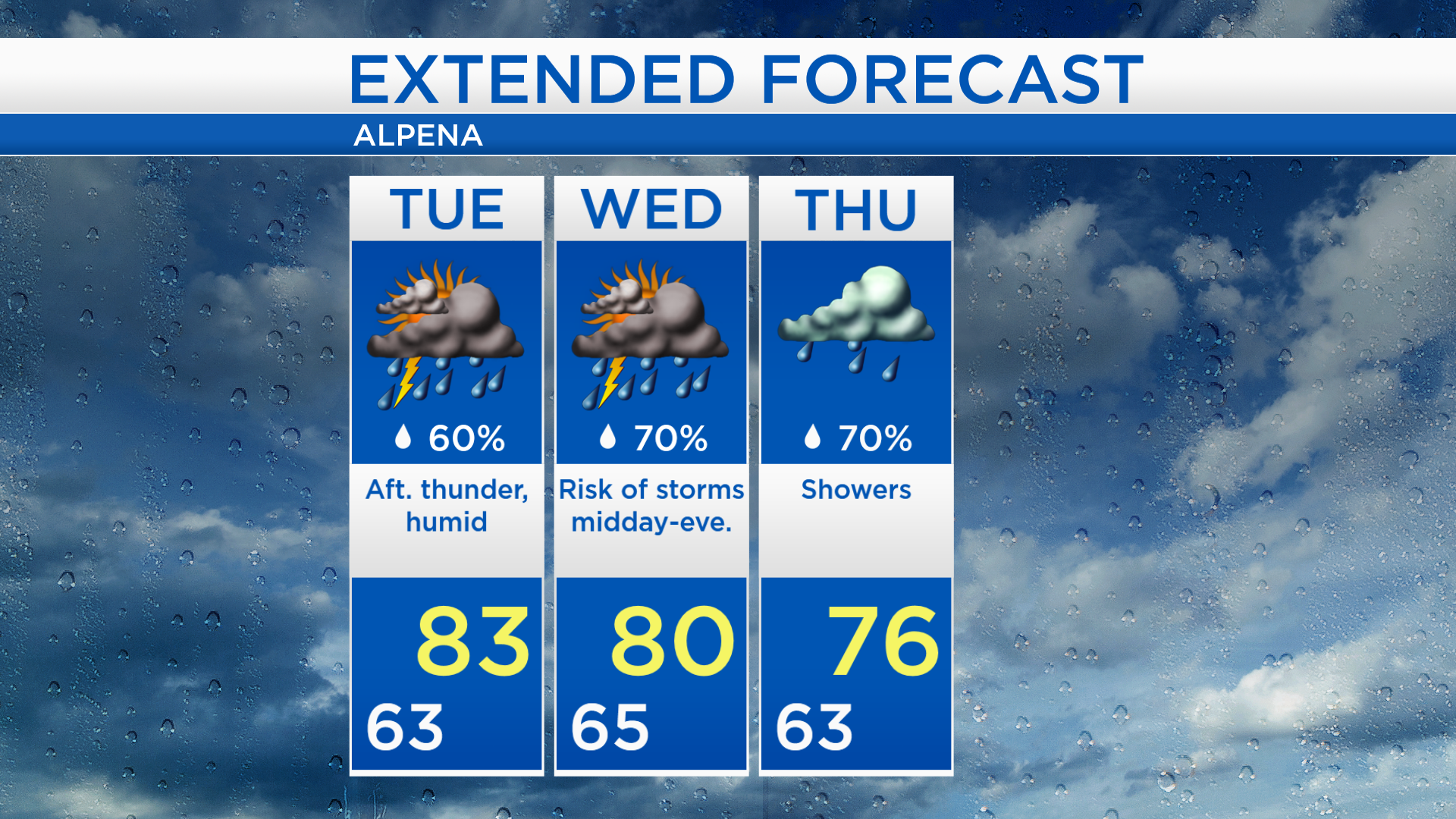
High humidity continues through midweek
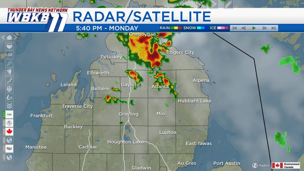
A muggy and unstable air mass has moved into Northern Michigan. A few thunderstorms developed this afternoon, mostly near and north of M-32, these will likely wane after sunset. We could have a repeat performance tomorrow with a risk of afternoon thunderstorms popping up.
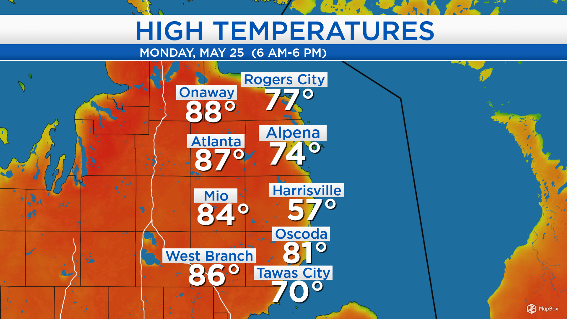
Except at the shoreline, high temperatures reached the middle 80s. A breeze from the east or southeast kept temperatures a little cooler at the shoreline, where highs reached 74 degrees in Alpena and 77 degrees in Rogers City. Elsewhere, it was a toasty afternoon with temperatures that heated up to 87 degrees in Atlanta and 86 degrees in West Branch.
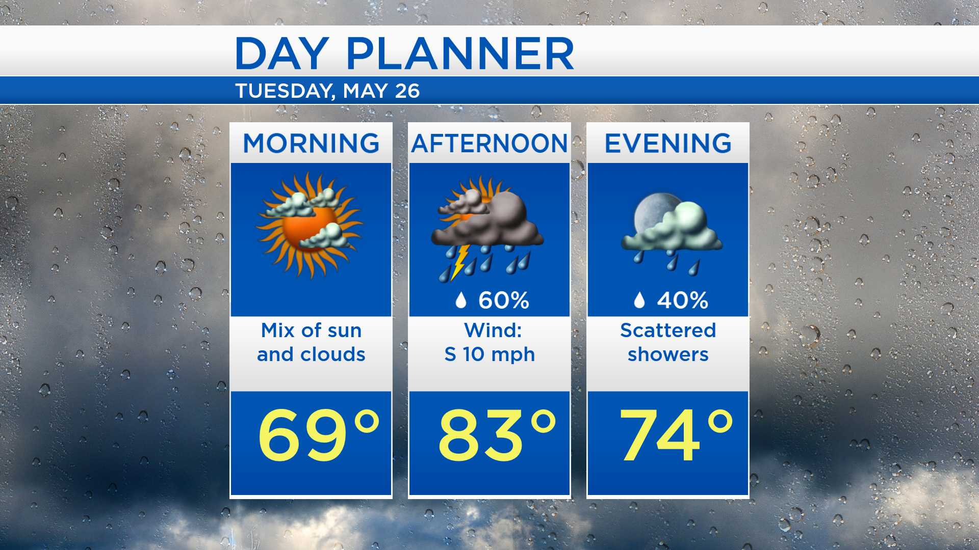
Low temperatures overnight will be near 63 degrees and partly cloudy skies are expected through much of the nighttime hours. Morning temperatures will be in the upper 60s to lower 70s with a mix of sun and clouds. Scattered thunderstorms could move into our area during the afternoon and highs will warm to about 83 degrees. Chances of scattered showers will decrease in the evening with temperatures in the lower to middle 70s.
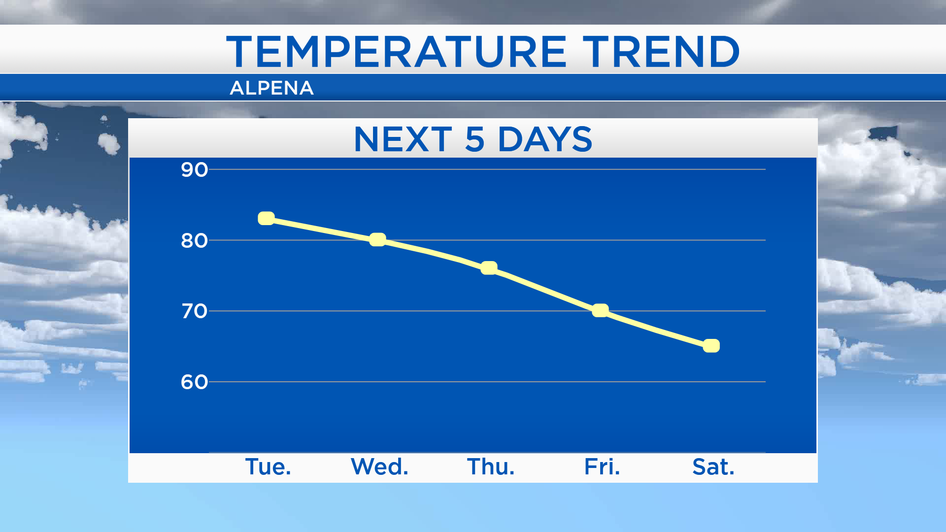
It’ll still feel very warm and muggy for Tuesday and Wednesday. Highs will be in the lower 80s Tuesday and near 80 degrees Wednesday. Highs on Thursday will be in the middle/upper 70s. A cold front will move through our area Thursday and bring much cooler temperatures for the end of the week. Friday, highs will be near 70 degrees with a completely dry day. Saturday will be even cooler, highs will be only in the middle 60s with bright skies.
Tuesday, there will be a risk of afternoon thunderstorms with highs in the lower 80s and high humidity. Wednesday will have periods of showers from midday through evening and a risk of thunderstorms. Highs on Wednesday will reach about 80 degrees. Showers are expected Thursday with highs near 76 degrees. For the rest of Northeast Michigan’s weather forecast, watch the latest weather video by clicking the weather tab at the top of the page.