Gray weekend; Much warmer next week with showers
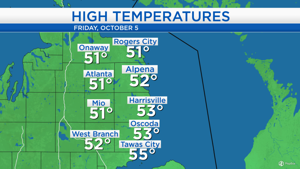
High temperatures today reached the lower 50s with cloudy skies and light, patchy showers. More widespread showers will move in tonight through Saturday afternoon.
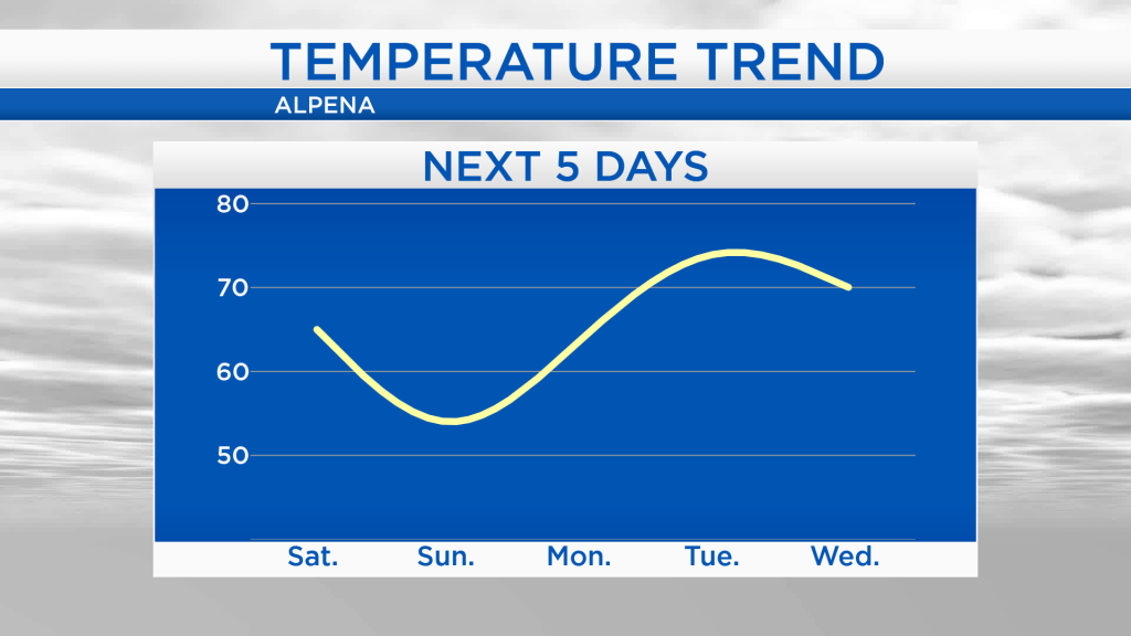
Although it has felt chilly across our area, it is even colder to our northwest, where snow has been falling in North Dakota for the second day in a row. Cooler temperatures will move into our area briefly on Sunday, then a significantly warmer trend will start Monday.
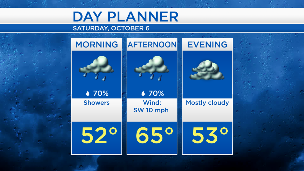
Showers are expected tomorrow morning with temperatures in the lower 50s. Afternoon highs will warm to the mid-60s, then showers will gradually depart to the east by the evening.
Temperatures will warm into the 60s tomorrow because of a breeze out of the southwest, despite the incoming showers. Winds out of the north on Sunday will bring one day of colder temperatures with afternoon highs in the mid-50s. After that, winds will gradually shift around out of the southwest by Tuesday, bringing much warmer temperatures, reaching the 70s.
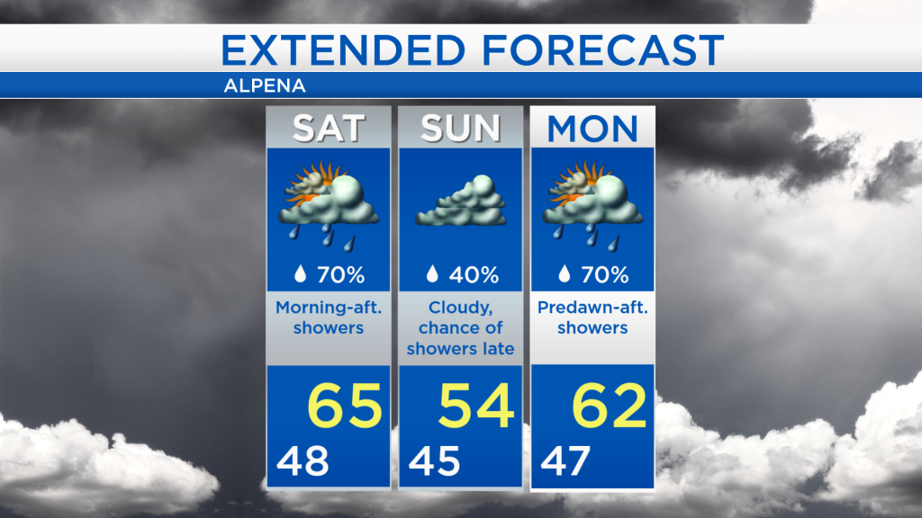
For Saturday, a few showers will come and go through the area as highs reach the mid-60s. Most of Sunday should remain dry until the nighttime, but cooler temperatures will move in with highs around 54 degrees. More showers are expected Monday in the early-morning through afternoon as highs warm into the 60s. Highs will warm to the 70s on Tuesday with more showery weather. For the rest of Northeast Michigan’s weather forecast, watch the latest weather video by clicking the weather tab at the top of the page.