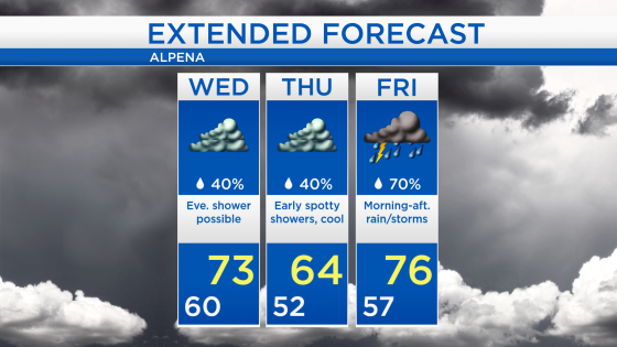
Gray skies but little rainfall through Thursday; Substantial rainfall Friday
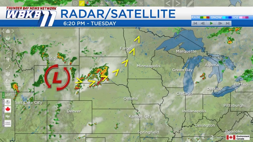
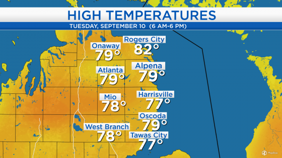
High temperatures today reached the upper 70s for most of Northeast Michigan. A warm front has progressed from the plains and moved northeastward, now parked north of our area. The rapid change of air mass helped bring rain and thunderstorms this morning. Downpours were caused by warm air initially being forced overtop of the pre-existing cooler air mass we had Monday. Typically, the wind direction shifts after a front moves through — winds from the southwest have brought warmer temperatures and higher humidity to our area.
Cloudy skies but not much rainfall will continue for the next 24 hours. To our west, the nearest area of rainfall is moving through South Dakota. The next storm system is already developing over Colorado, Wyoming and Montana. It will bring our next substantial round of rainfall, beginning early Friday.
Low temperatures tonight will get close to 60 degrees. High temperatures will climb slightly above normal, getting to about 73 degrees with light winds from the northwest. A few showers are possible tomorrow evening until Thursday morning.

A few showers are possible late tomorrow to early Thursday. High temperatures will reach the lower 70s tomorrow, and get cooler on Thursday because of winds off of Lake Huron. Winds pick up out of the south on Friday just in advance of the next storm system. Rain and thunderstorms are likely Saturday, and high temperatures will warm to the middle 70s. For the rest of Northeast Michigan’s weather forecast, watch the latest weather video by clicking the weather tab at the top of the page.