Getting colder this week; Snow showers Wednesday

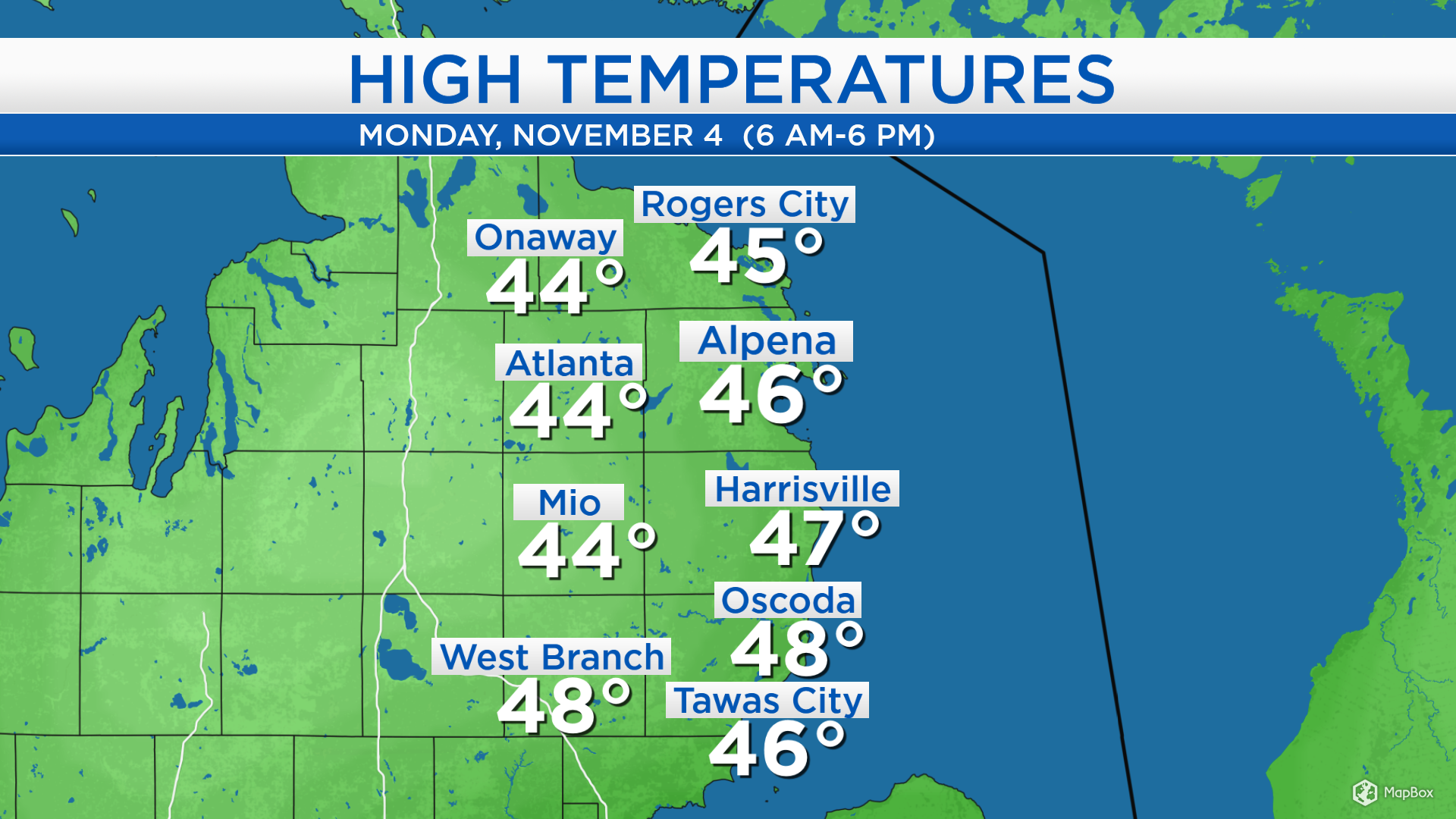
High temperatures today reached the middle to upper 40s across Northeast Michigan. Today’s high temperatures got up to values near normal for early November with winds out of the southwest. An incoming cold front will pass through our region tonight — as a result, temperatures will become much colder for the middle of the week.
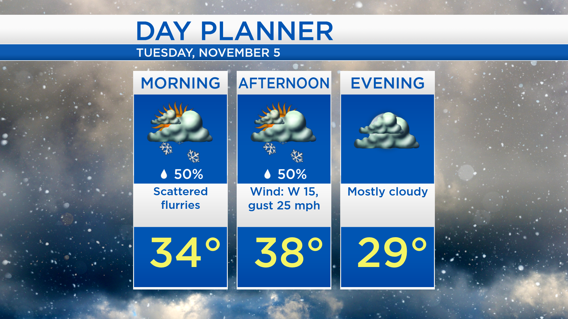
Showers from early this morning have since moved well to the east of our area. The incoming cold front has initiated the late-day round of showers. Showers this evening will transition to flurries after midnight as temperatures drop to the lower 30s. The weather pattern across most of the Midwest is largely unsettled with areas of scattered snow showers. Likewise, our weather will be unsettled over the next few days, although the most notable chance of snow will likely materialize on Wednesday.
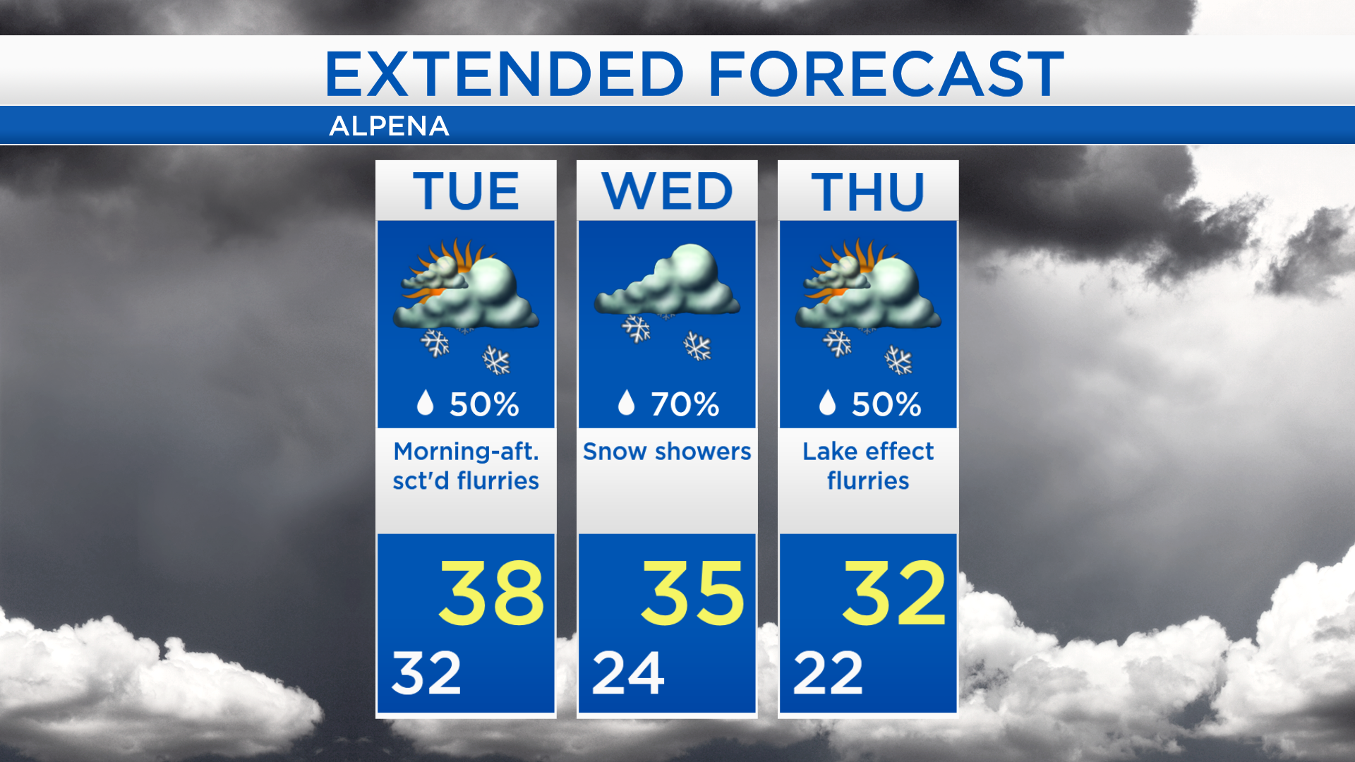
Low temperatures tonight will cool to the lower 30s. Scattered flurries are possible tonight through tomorrow afternoon, then quieter weather is expected tomorrow evening/nighttime. Snowfall tomorrow will amount to very little, under 1 inch. Tomorrow afternoon will be cool and breezy, high temperatures will reach about 38 degrees and winds will occasionally gust up to 25 mph.
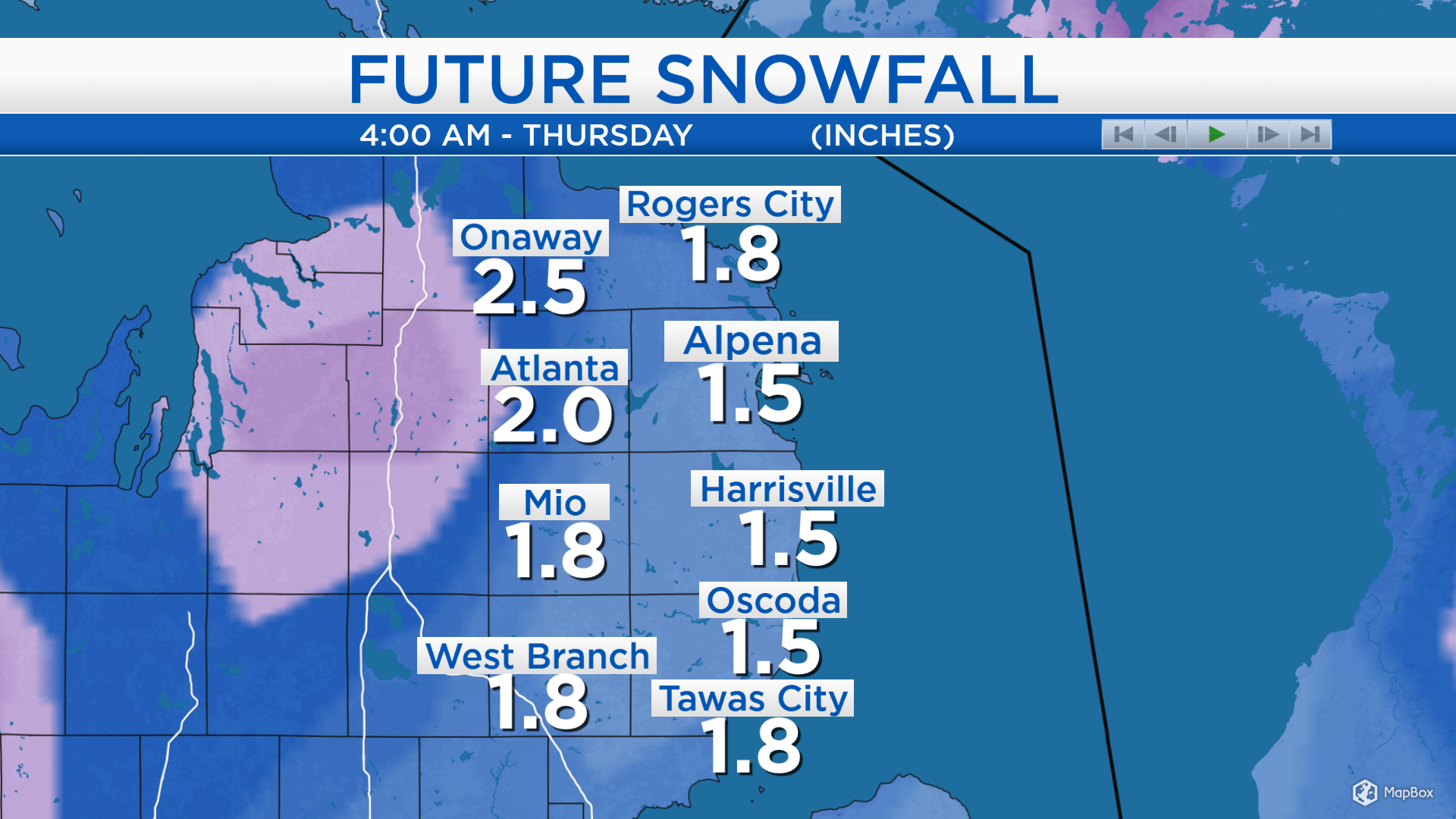
One computer model of total snowfall through early Thursday shows about 1 inch of snow near the shoreline and increasing amounts toward I-75. Most of the depicted snowfall will come Wednesday. I am skeptical of snowfall amounts over 1 inch at the shoreline, south of Alpena to Saginaw Bay. Elsewhere, 1-3 inches will be likely for most. 3-6 inches of total snowfall are possible for the areas shaded in purple, near and west of I-75. The map below shows forecast total amounts from Monday night through early Thursday.
A few flurries are possible tomorrow but amounts will be unsubstantial, and high temperatures will reach the upper 30s. Temperatures will get even colder for the middle of the week. Highs will reach the middle 30s on Wednesday, and snow showers are likely so allow extra time for traveling. Lake effect flurries off of Lake Michigan and Lake Huron are possible on Thursday with winds from the north-northwest. Early-morning temperatures will start in the lower 20s and afternoon highs will reach only the lower 30s on Thursday. For the rest of Northeast Michigan’s weather forecast, watch the latest weather video by clicking the weather tab at the top of the page.