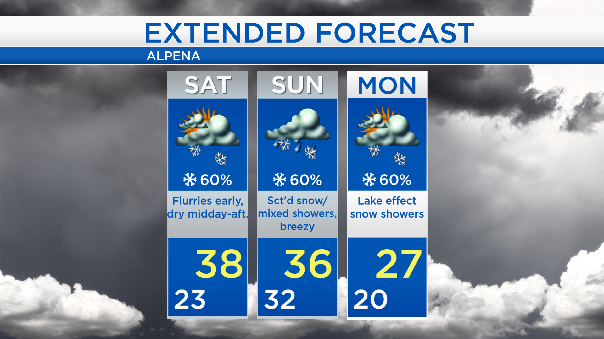
Flurries early Saturday then a dry afternoon; More snow showers/mixed precip. Sunday
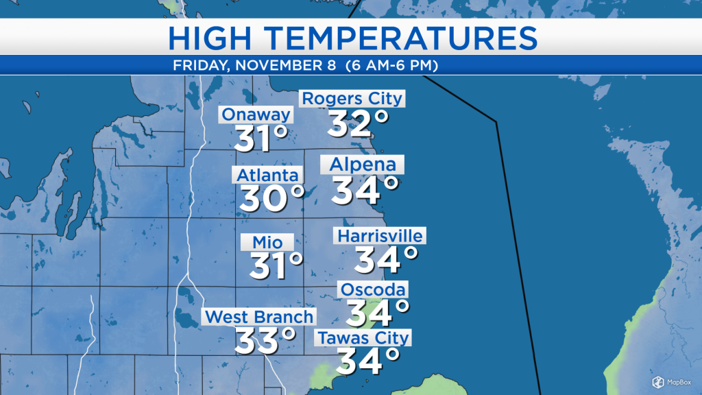
High temperatures today reached the lower 30s inland, and middle 30s at the shoreline. Winds were light, from the west at 5-10 mph. Slightly milder temperatures will move in tomorrow, aided by winds from the southwest.

A few isolated snow showers moved through Northeast Michigan, although most of today’s snowfall was concentrated in Cheboygan and Emmet counties. Snow currently located to the northwest will move toward our area, so chances of flurries will increase late tonight into early tomorrow. Subsequent rounds of snow showers or mixed precipitation are expected Saturday night and Sunday.
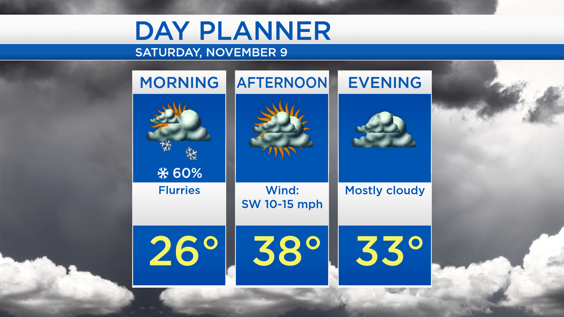
Overnight lows will cool to about 23 degrees. Flurries are possible tomorrow morning, then mostly cloudy skies and mainly dry conditions are likely in the afternoon and evening. High temperatures will climb to about 38 degrees tomorrow afternoon with winds from the southwest at 10-15 mph.
Most of tomorrow will likely feature dry weather, and high temperatures will get slightly milder compared to the past couple days. Scattered snow showers or a rain/snow mix are expected Sunday as a cold front moves through Northern Michigan. Once Sunday’s cold front moves east of our area, winds out of the north will bring much colder air and some lake effect snow early next week. Temperatures will reach the middle/upper 20s Monday afternoon, then drop to the lower teens early Tuesday. For the rest of Northeast Michigan’s weather forecast, watch the latest weather video by clicking the weather tab at the top of the page.