Dry weather to start the weekend, until the next rain-maker moves in
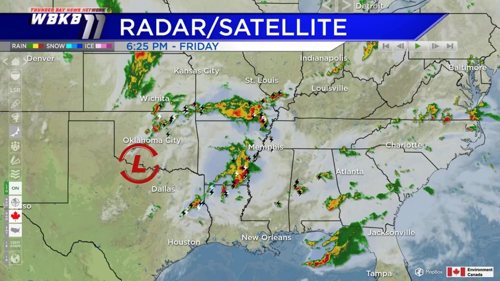
A low pressure system near Duluth, Minnesota has generated scattered showers out ahead of it. Because of the counter-clockwise flow around low pressure, we have seen showers moving from south to north through our area. As this first low pressure system moves northward and away from our area, we will get a period of dry weather overnight through the first half of Saturday. The next low pressure system will be tracking northward, out of Oklahoma. This storm system will bring our next chance of rain, beginning late Saturday.
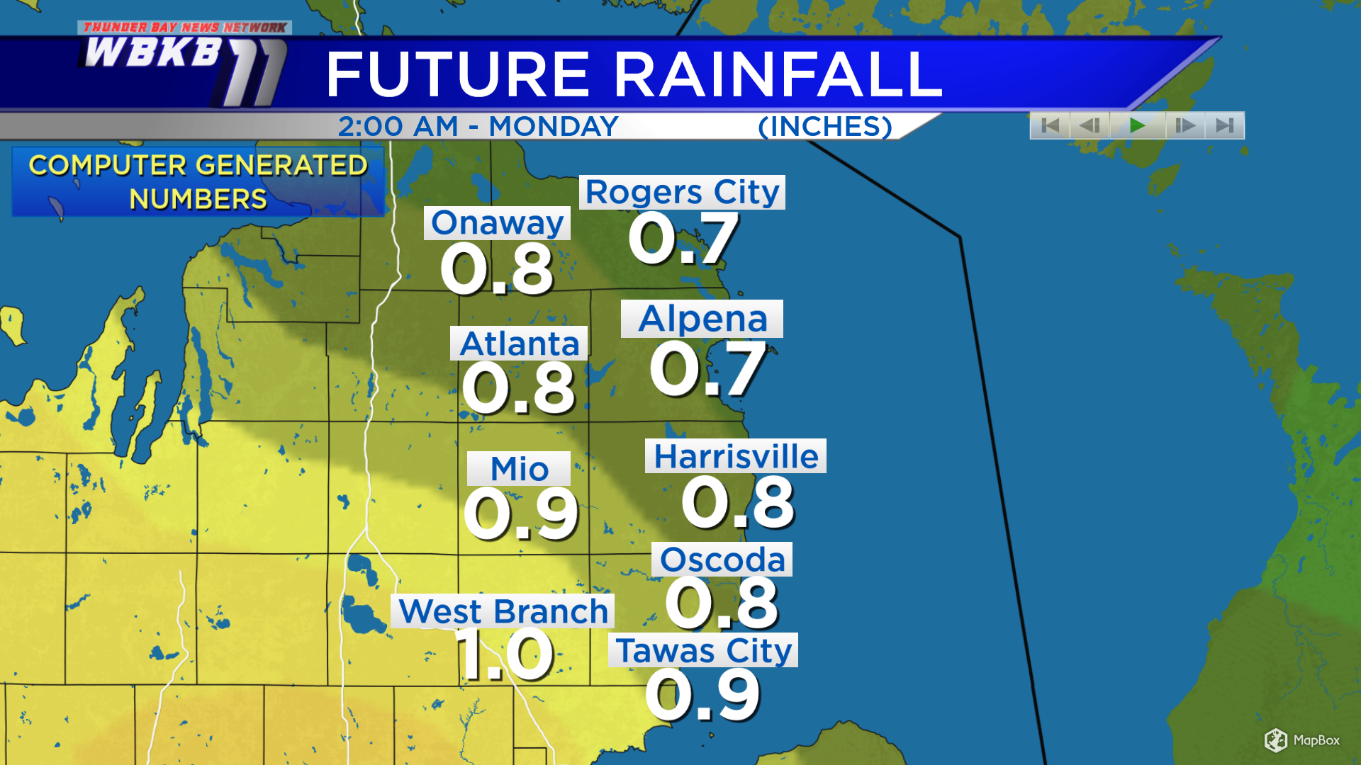
The future rainfall map goes through Sunday night. Some of the plotted numbers might be a little high. The general idea is to expect 0.5-0.75 inches of rain over the weekend. The majority of the rainfall will take place from late Saturday to Sunday midday.
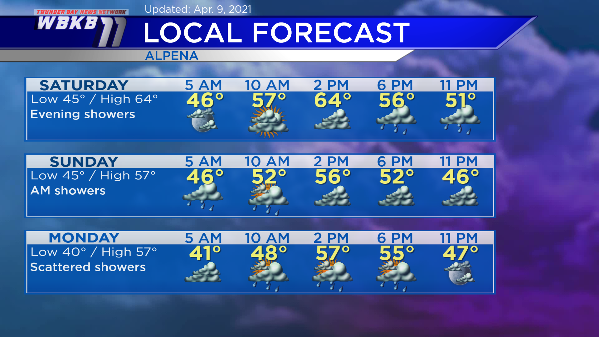
Saturday: The first half of the day will be dry along with warm temperatures in the afternoon. Showers will arrive late-day/evening. Predawn lows will be near 45 degrees. Temperatures will rise to the upper 50s in the late-morning. Afternoon highs will get up to about 64 degrees. Evening temperatures will be in the middle/lower 50s.
Sunday: Begins with showers in the morning, then likely drier late-day. Early-morning lows will be close to 45 degrees. Afternoon temperatures will feel cooler with highs around 57 degrees. Evening temperatures will be near 50 degrees or in the upper 40s.
Monday: A chance of scattered showers. Early-morning temperatures will begin near 40 degrees. Afternoon highs will reach about 57 degrees. Evening temperatures will be going into the lower 50s/upper 40s.
For the rest of Northeast Michigan’s weather forecast, watch the latest weather video by clicking the weather tab at the top of the page.


