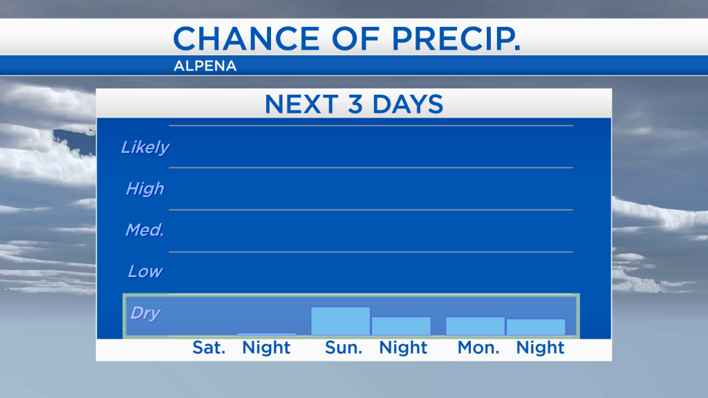
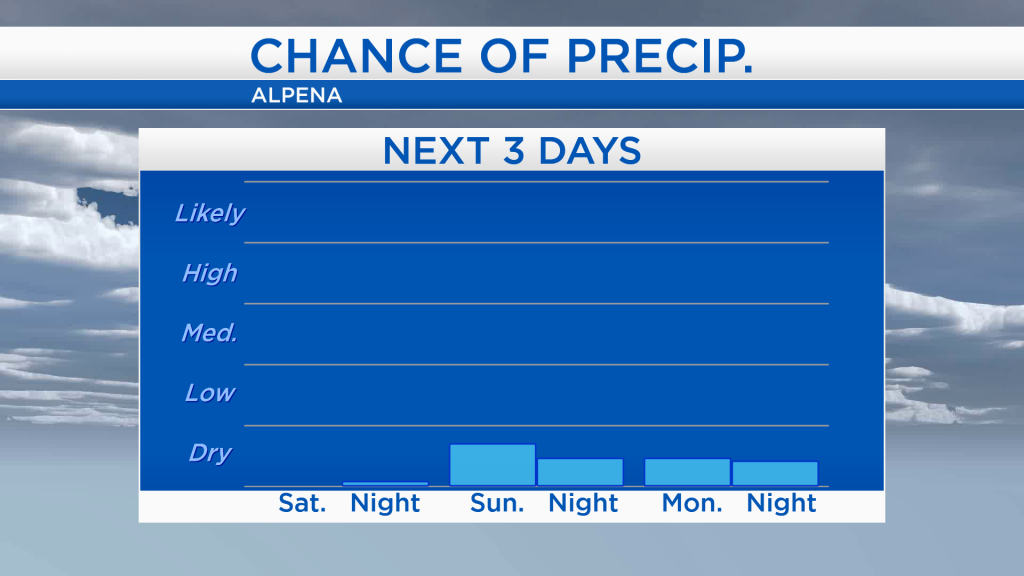
Completely dry this weekend with cooler temperatures
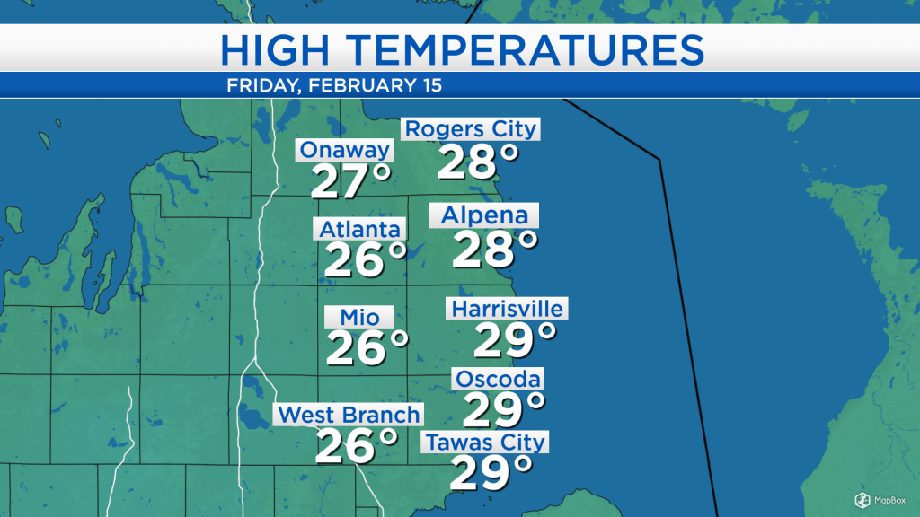
High temperatures today reached the middle to upper 20s around Northeast Michigan. Gusty winds out of the west helped generate lake effect snow off of Lake Michigan, and a few snow showers have reached our side of the state occasionally throughout the day. Winds have been sustained at 15-20 mph with occasional gusts reaching 30-40 mph. Winds will begin to ease tonight as calmer weather moves in.
Lake effect snow will continue this evening, most intense close to and west of I-75. Snow showers will decrease in our area, leaving us with mostly cloudy skies tonight. Drier weather and some clearing from Minnesota and North Dakota will move into our area tomorrow.
It has been a while since we have seen our chances of precipitation so low for a few back to back days. The last time we had two days in a row of completely dry weather was February 1-2 — two weeks ago, and the last time we got to enjoy four days in a row of dry weather was January 3-6 — more than a month ago! The chance of precipitation for the next 3 days will go into the dry category.
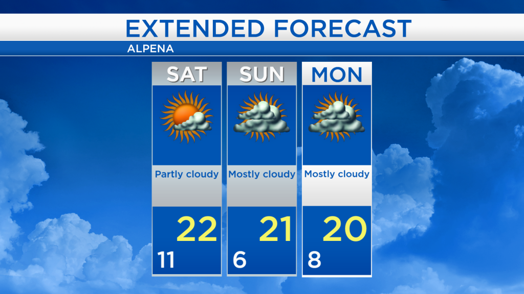
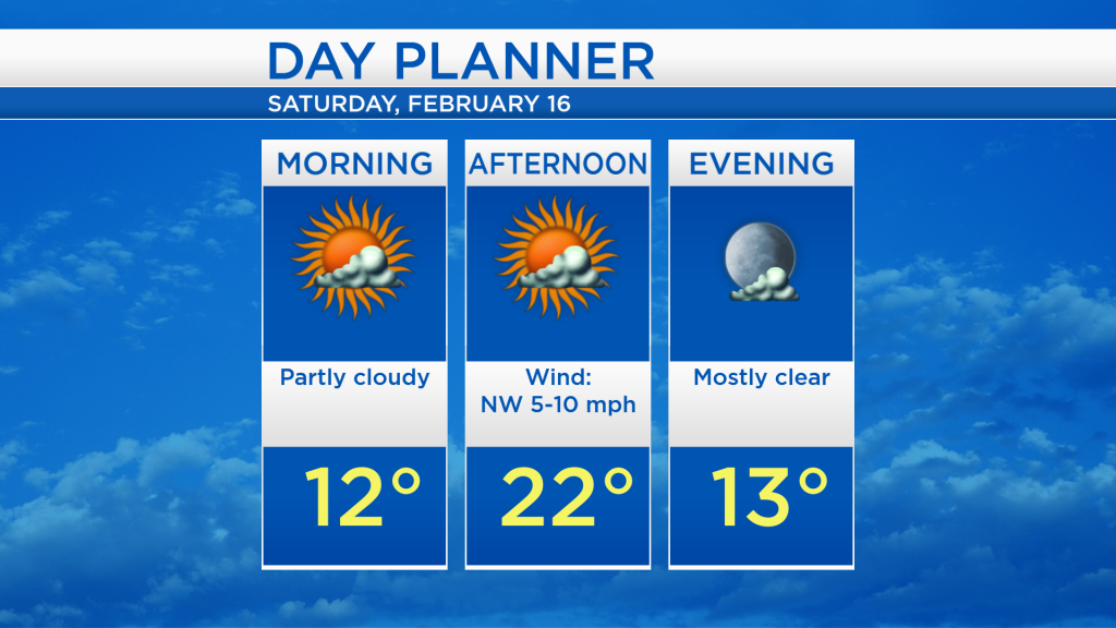
Overnight, low temperatures will cool to around 2 degrees with mostly cloudy skies although wind chill values will drop to -10. Some sunshine is expected tomorrow with partly cloudy skies throughout the day and high temperatures reaching around 22 degrees. Wind speeds will decrease for tomorrow, out of the northwest at 5-10 mph.
Dry weather will last all weekend long. More cloud cover is expected on Sunday with a cool temperatures in the early-morning, around 6 degrees, then reaching around 21 degrees Sunday afternoon. Mostly cloudy skies will continue early next week with high temperatures close to 20 degrees. The next significant chance of snow will arrive on Wednesday. For the rest of Northeast Michigan’s weather forecast, watch the latest weather video by clicking the weather tab at the top of the page.