Colder temperatures will move in for the end of the week
High temperatures today reached the middle 40s in Northeast Michigan. Winds out of the southwest brought the warmer air to our area. A weak cold front will move through tonight, but chances of drizzle/snow showers will be minimal. Winds will then become out of the northwest tomorrow and colder temperatures will move in. Notice the colder temperatures over Minnesota, that’s the air mass on the way in, giving daily highs in the 30s.

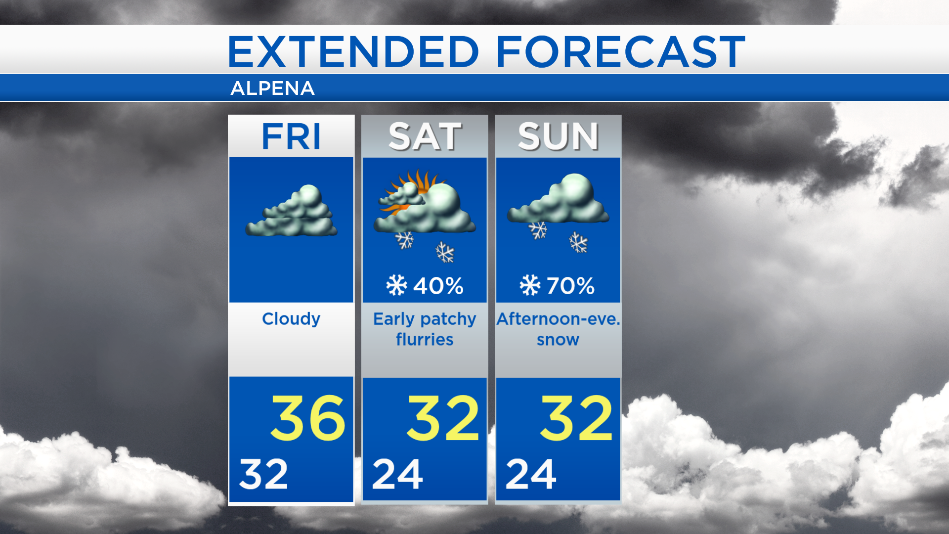
It has been mainly cloudy across Northeast Michigan today. Gray skies will continue for the next two days with only a low chance of flurries early Saturday. A storm system coming from western Canada will bring a more likely chance of snow on Sunday.
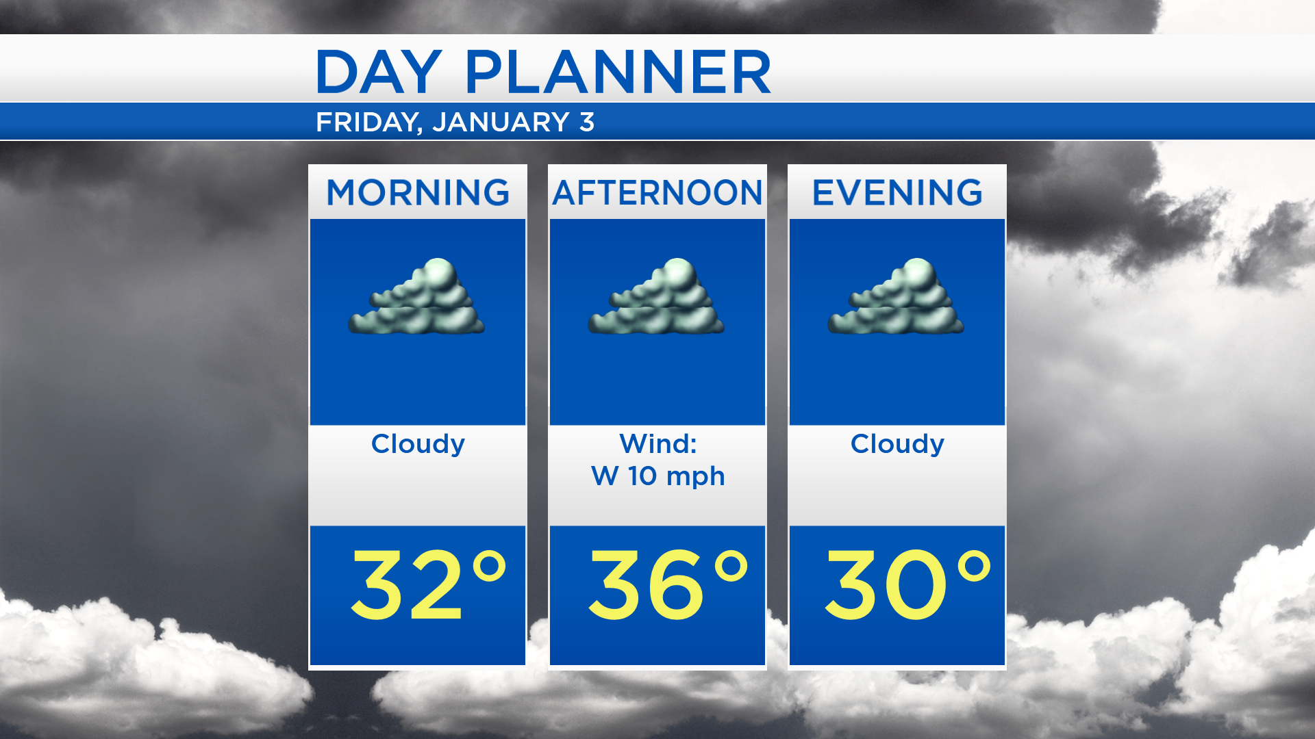
Low temperatures overnight will cool to about 32 degrees. Tomorrow will be cloudy with afternoon highs near 36 degrees. A light breeze will come from the west, close to 10 mph.
Gray skies will persist through the weekend. High temperatures tomorrow will be in the middle to upper 30s. Temperatures will cool to the lower or middle 20s early Saturday and afternoon highs will reach the lower 30s. A few flurries are possible early Saturday, but most of the day should be dry. Widespread snow showers are expected Sunday with highs in the lower 30s.
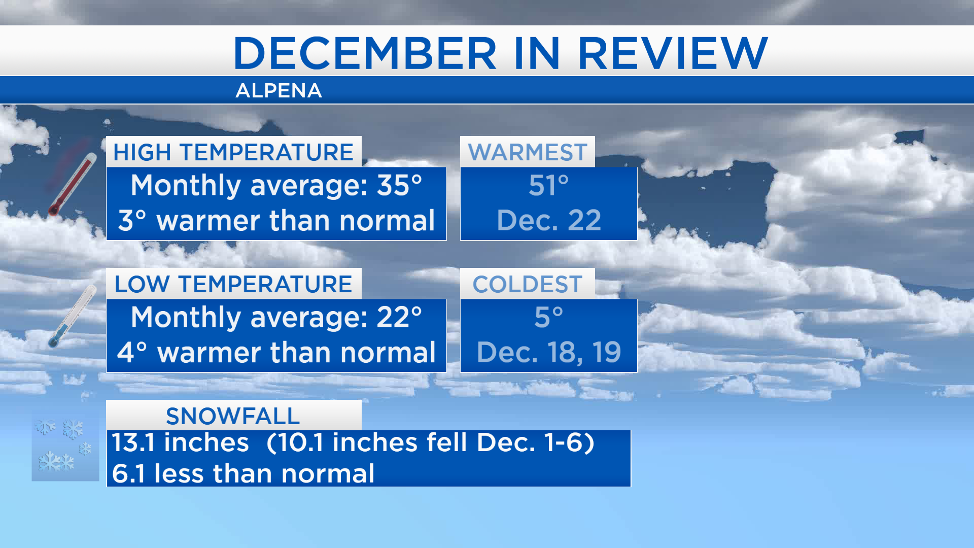
Looking back at December 2019, last month was warmer and less snowy than ‘normal.’ The average of all the daily high temperatures was 35 degrees, and that’s 3 degrees warmer than normal. Similarly, the average of all the low temperatures throughout December was also warmer than normal. Total snowfall for December was about 13 inches, most of that fell in the first week of the month. For the rest of Northeast Michigan’s weather forecast, watch the latest weather video by clicking the weather tab at the top of the page.