Cold temperatures tonight through the weekend; Rain to start the upcoming week
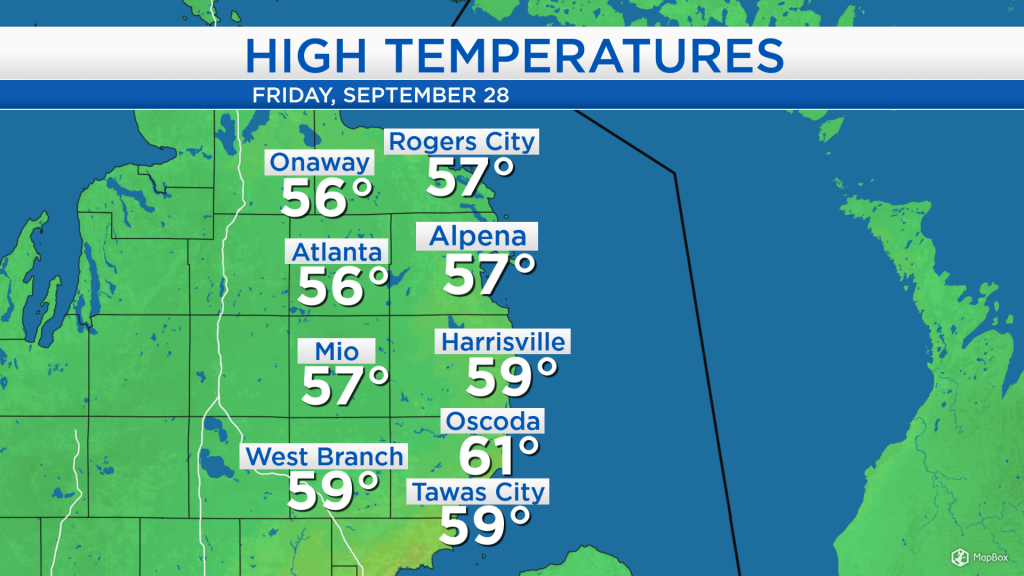
High temperatures today reached the middle and upper 50s combined with a blanket of cloud cover and winds out of the west at 10-15 mph.
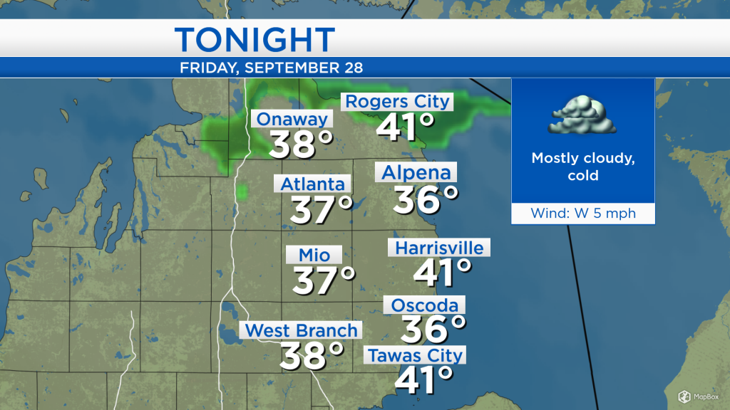
Winds will shift out of the northwest behind a cold front currently progressing through southern Lower Michigan, northern Illinois, and southern Iowa. Plenty of cloud cover remains across the Midwest, behind the cold front. Also, colder temperatures will continue to come in from the northwest overnight.
Temperatures tonight will drop into the mid-30s, except a little warmer at the immediate shoreline. Light winds and cold temperatures entering the area will let temperatures drop to very cold values.
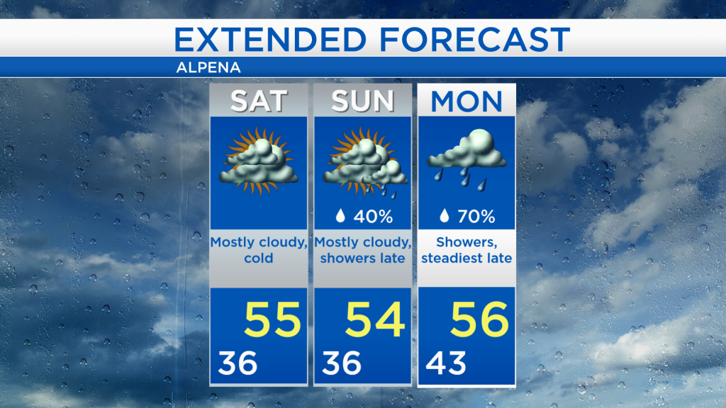
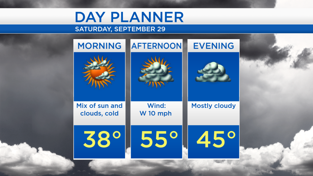
For Saturday, morning temperatures will start in the 30s, then reaching only the mid-50s in the afternoon. Mostly cloudy skies will last from the late-morning through the evening, and winds will come from the west at about 10 mph.
Gray weather will continue on Sunday, though most of the day should remain dry. Once again, early-morning temperatures will start with cold lows in the mid-30s, then highs will reach the mid-50s Sunday afternoon. By the late-afternoon or evening hours, a chance of showers will enter the area. Periods of rain are expected Monday, then temperatures will warm into the upper 50s through mid-60s during the upcoming week. For the rest of Northeast Michigan’s weather forecast, watch the latest weather video by clicking the weather tab at the top of the page.