Clearing skies Saturday; Warmer and more humid this weekend

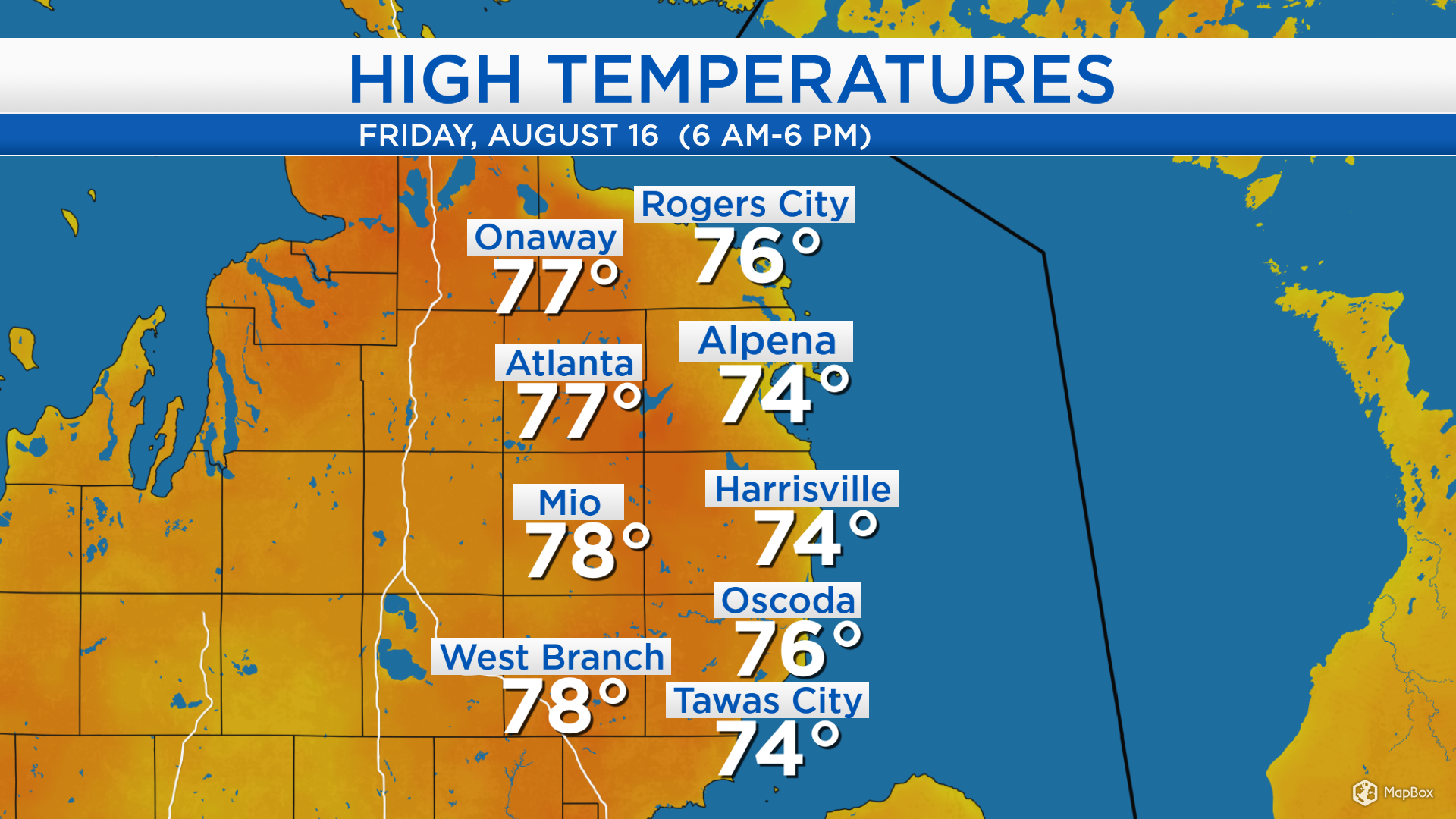
High temperatures today reached the middle 70s for most of Northeast Michigan, although some locations farther inland had highs that climbed to the upper 70s. Light winds from the southeast, off of Lake Huron, kept the temperatures just slightly below normal. Cloud cover has been variable, allowing for some sunny breaks throughout the day.
A weak disturbance is producing showers tonight, which will move quickly to the east. Plenty of cloud cover will persist early tomorrow, then begin to clear midday and into the afternoon. Dry weather will continue through Saturday night and early Sunday. The next storm system, still currently over western Canada, will travel toward the southeast and bring a chance of showers and thunderstorms Sunday afternoon.
Scattered showers will move through our area tonight and low temperatures will cool to the upper 50s. Tomorrow will start with mostly cloudy skies and morning temperatures in the lower 60s. Partly cloudy skies are expected tomorrow afternoon, as high temperatures warm to the lower 80s.

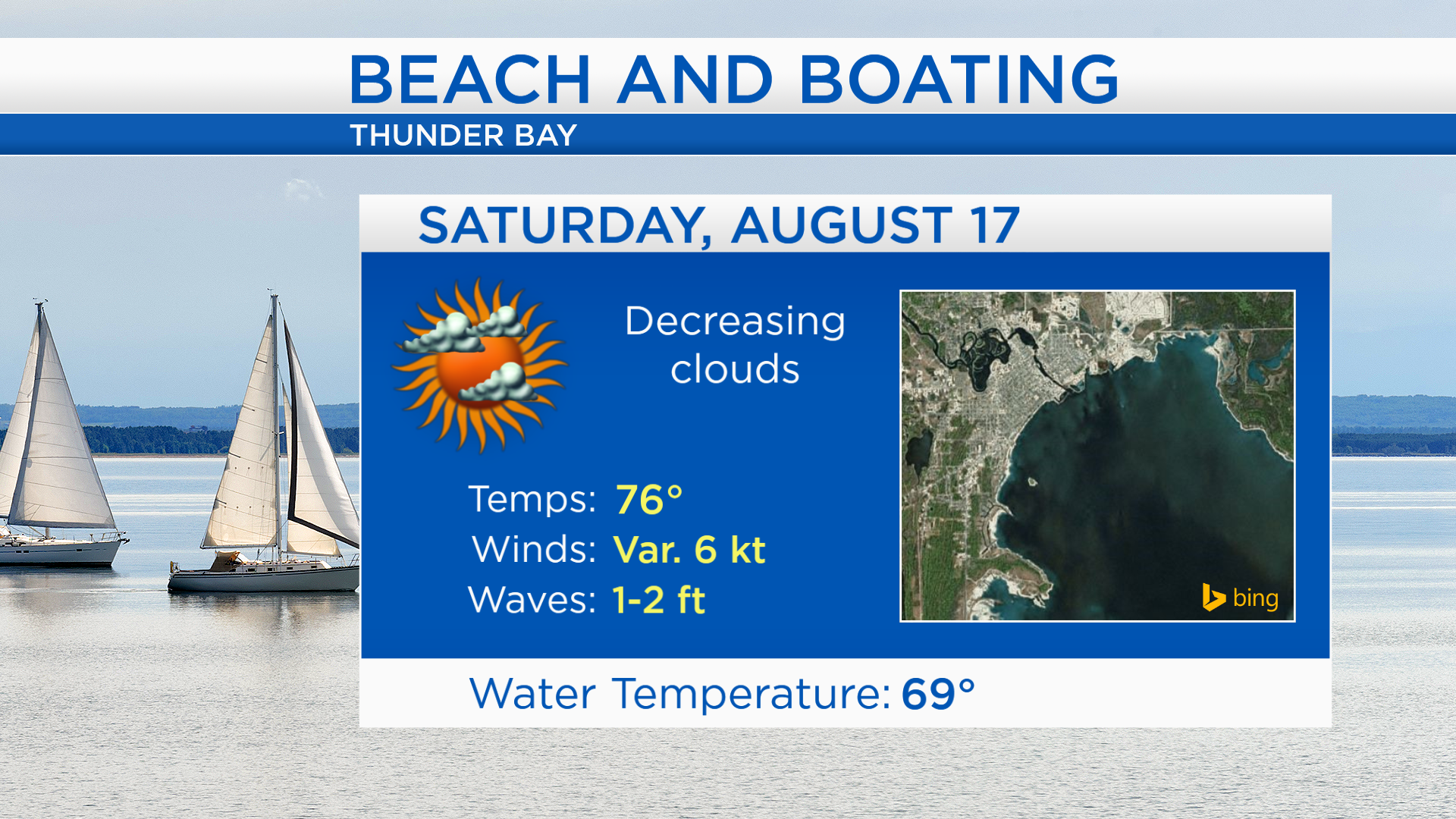
Saturday is absolutely the better day for outdoor plans. For any activities at the beach, high temperatures will reach the middle to upper 70s at the shoreline. Winds will be light and variable, approximately 5 knots, and wave heights will reach 1 to 2 feet. On Sunday, thunderstorms are possible mainly in the afternoon.
Afternoon temperatures tomorrow will reach close to 82 degrees with decreasing cloud cover, becoming partly cloudy. Humidity will increase Sunday, and afternoon highs will get close to 83 degrees. Sunday morning will start with dry weather, then afternoon showers and thunderstorms are possible. Dry weather is forecast for Monday with partly cloudy skies and high temperatures near 84 degrees. For the rest of Northeast Michigan’s weather forecast, watch the latest weather video by clicking the weather tab at the top of the page.