Chilly Wednesday morning; Much warmer Thursday
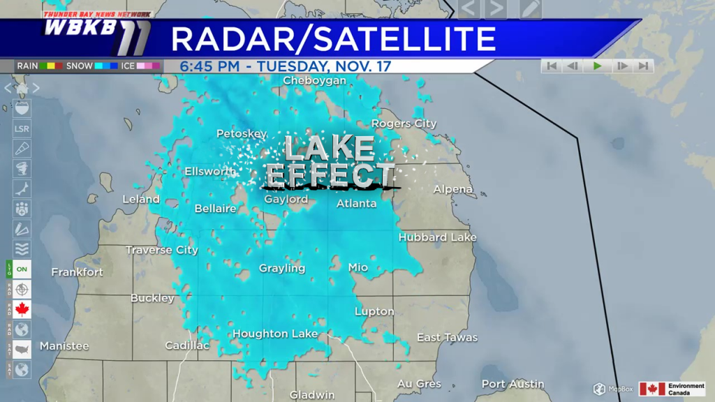
Winds from the northwest have generated lake effect snow showers off of Lake Huron and Lake Michigan. On the edge of some lake effect snow bands, Alpena has gotten just a few on/off flurries. Periods of snow have been more persistent north and west of Alpena. As winds lighten and shift direction, the chance of lake effect snow in Northeast Michigan will shut off heading into early Wednesday.
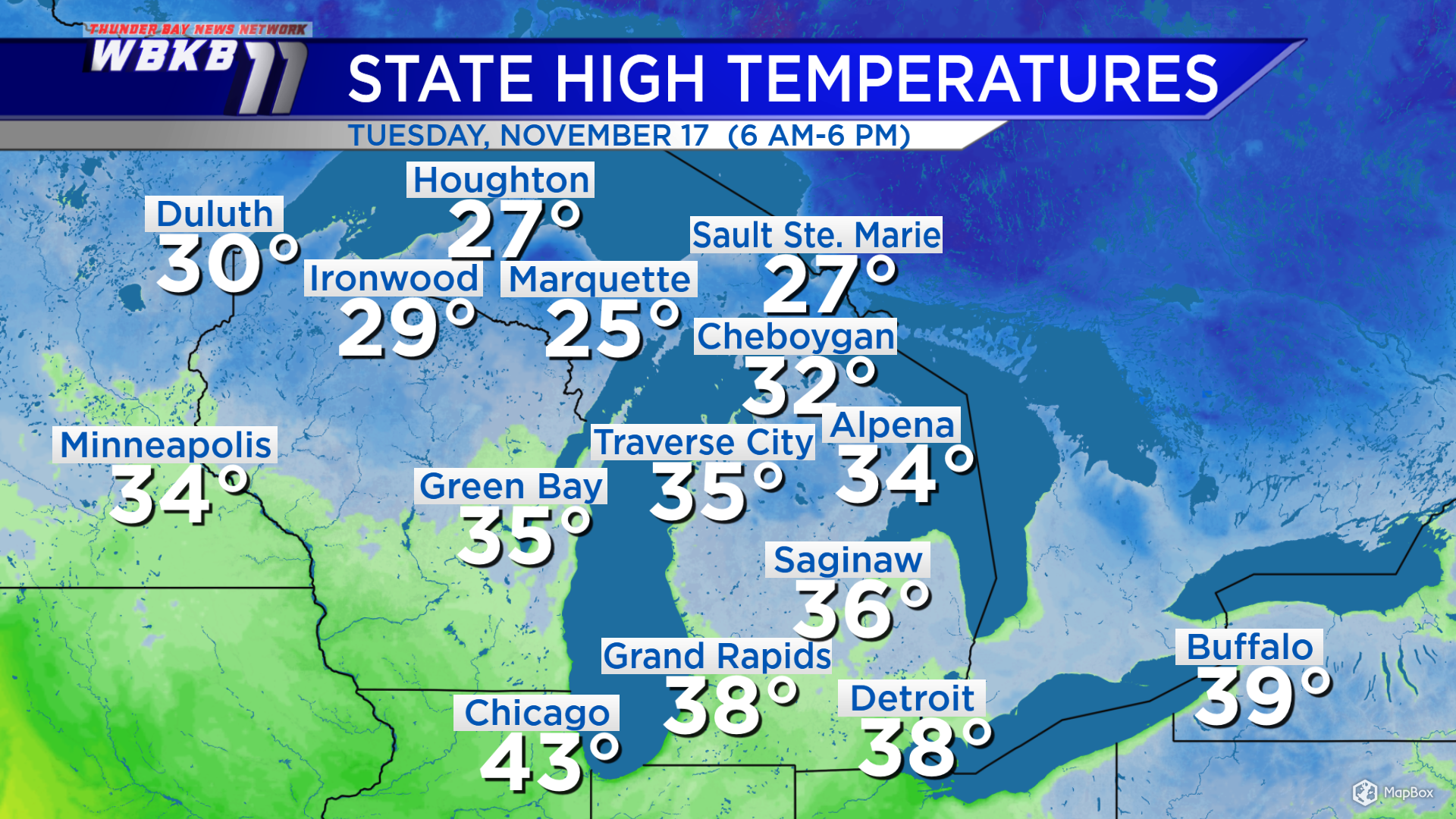
Winds from the northwest also helped bring cold temperatures. Highs today reached only 34 degrees in Alpena. Many places in the Upper Peninsula had temperatures that stayed stuck in the 20s. Wednesday will start with cold temperatures. By Thursday, winds from the southwest will bring much warmer temperatures to our area.
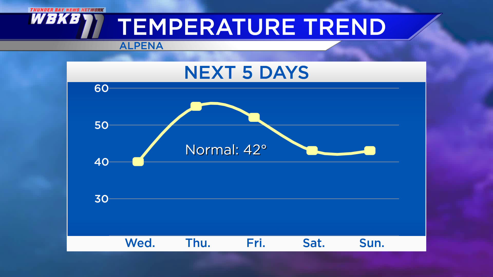
Wednesday, high temperatures will be near 40 degrees. Temperatures will warm to the middle 50s Thursday afternoon. Highs will reach the 50s again Friday. High temperatures will return to values near normal for the second half of November over the weekend with highs in the lower 40s.
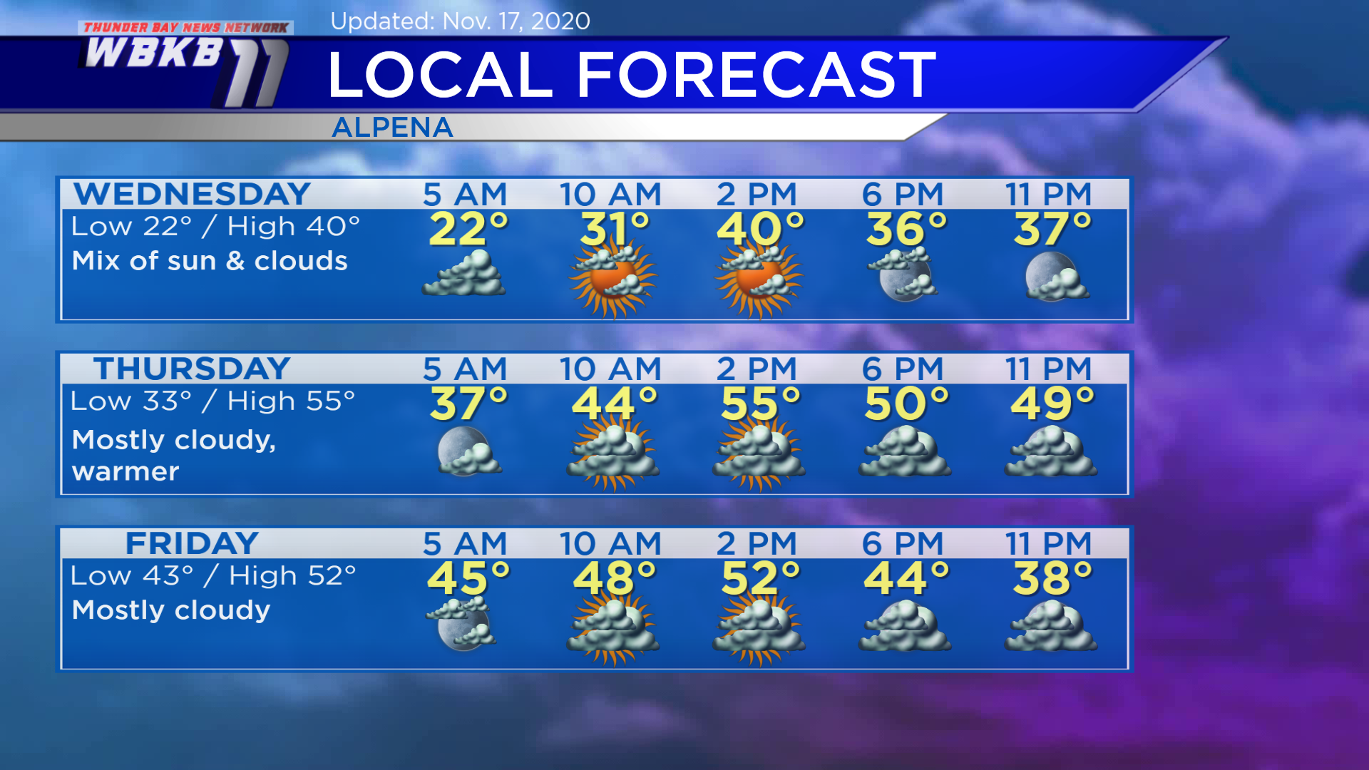
Wednesday: Cold early, a mix of sun and clouds. Temperatures will drop to the lower 20s predawn. Temperatures will climb to the lower 30s in the late-morning. Afternoon highs will reach about 40 degrees. Evening temperatures will be in the middle 30s.
Thursday: Warmer, mostly cloudy. Early-morning temperatures will start in the middle 30s. Late-morning temperatures will rise to the middle 40s. Afternoon highs will be near 55 degrees. Evening temperatures will be near 50 degrees or in the upper 40s.
Friday: Mostly cloudy, a warm morning. Temperatures will begin in the lower 40s predawn. Afternoon highs will be near 52 degrees. Evening temperatures will cool to the lower 40s/upper 30s.
For the rest of Northeast Michigan’s weather forecast, watch the latest weather video by clicking the weather tab at the top of the page.


