Brighter tomorrow and Thursday; Gray skies return late-week
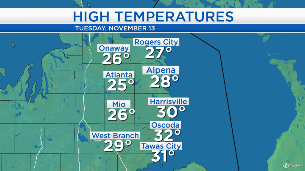
It felt very cold across Northeast Michigan as afternoon temperatures reached only into the upper 20s for most locations. Overcast skies lasted all day and occasional lake effect snow showers fell across the area combined with winds out of the west at 10-15 mph.
Lake effect snow continues to stream off of Lake Michigan, and will continue through tonight and tomorrow morning. Clearing skies are gradually shifting in from the west, and by tomorrow afternoon we will see some sunshine mixing in with partial cloud cover.
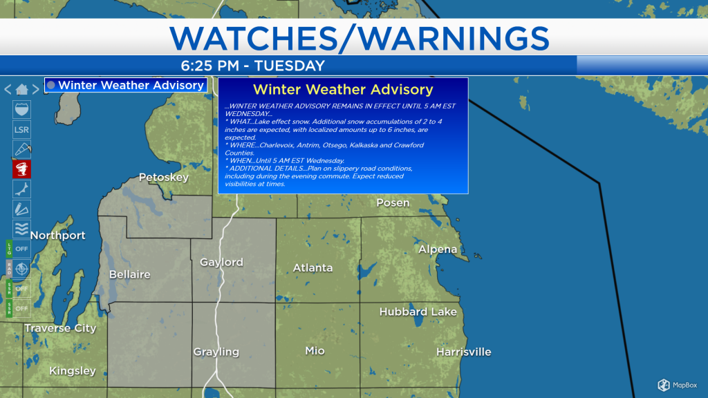
As the lake effect snow continues to affect the same areas, the National Weather Service has issued a Winter Weather Advisory for areas to our west, including Gaylord, Grayling, and Bellaire. For the area highlighted in gray, an additional 2-5 inches of snow is expected between this evening and tomorrow midday, where the greatest snowfall accumulations are expected to the west of I-75.
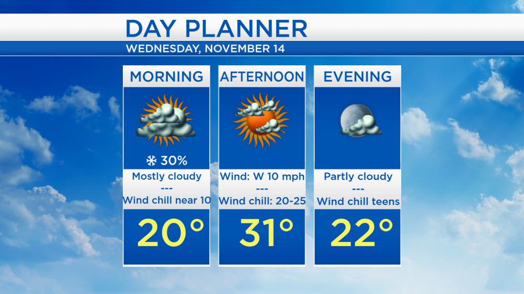
Overnight low temperatures will drop to the teens, then by tomorrow morning, temperatures will be around 20 degrees. Winds from the west at about 10 mph will produce wind chills near 10 in the morning, so you will want to dress for those cold wind chills when heading out at the start of the day. Afternoon highs will reach the lower 30s with decreasing cloud cover.
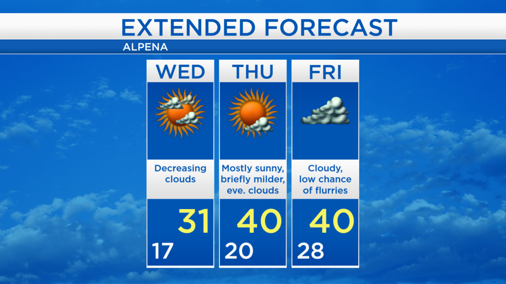
While the cold temperatures will last through tomorrow morning, we will see some milder temperatures beginning on Thursday. Dry weather and partly skies will continue on Thursday, and afternoon temperatures will warm to around 40 degrees. Highs will reach around 40 degrees again on Friday, though skies will become cloudy by then with a small chance of flurries. A higher chance of snow is expected at the start of the weekend as colder temperatures return to Northeast Michigan. For the rest of Northeast Michigan’s weather forecast, watch the latest weather video by clicking the weather tab at the top of the page.