Bright through midweek; Late-week rain

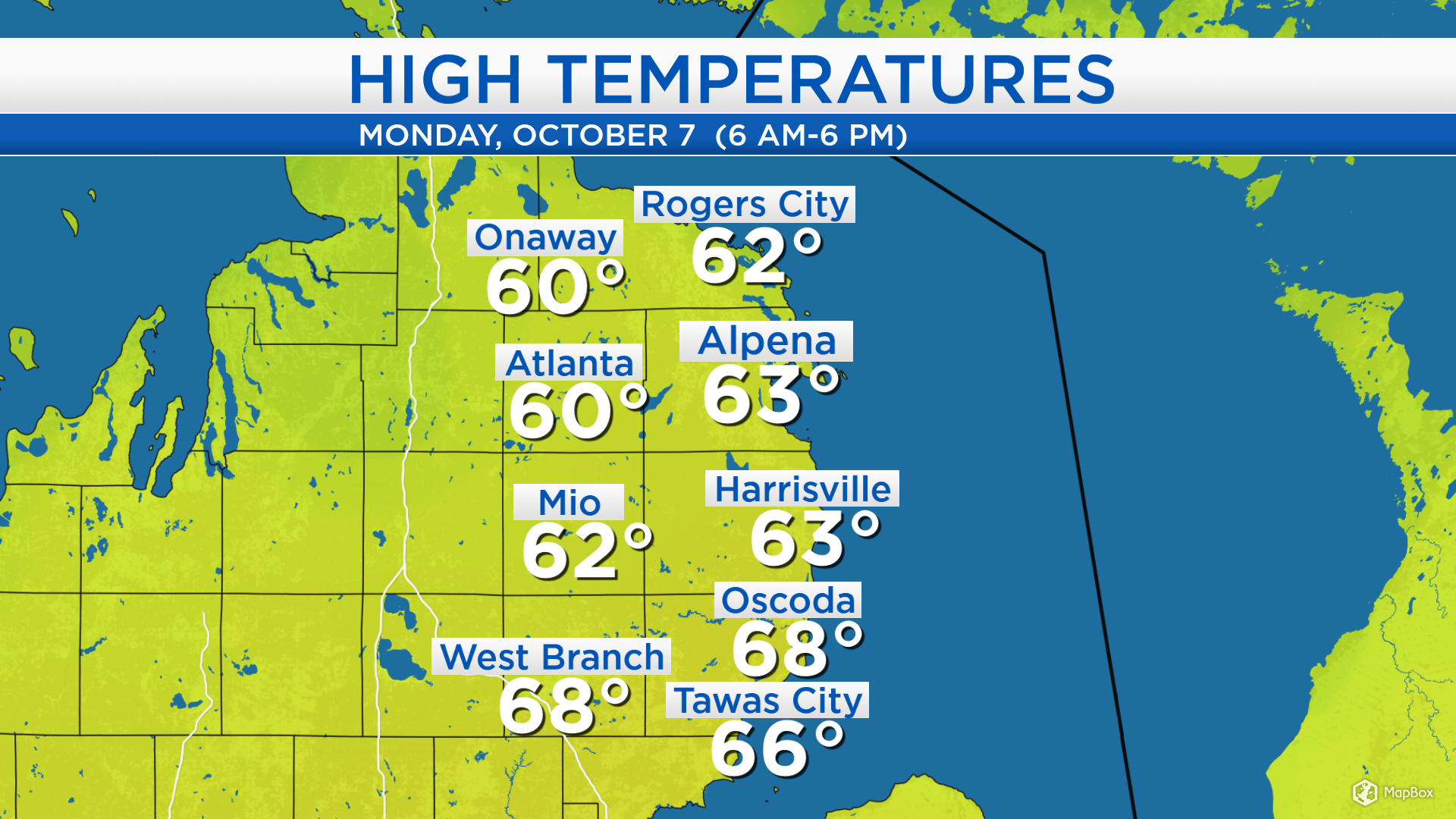
High temperatures today warmed to the lower and middle 60s across Northeast Michigan. A breeze from the west — with no influence off of Lake Huron — helped to bring relatively warm temperatures toward the lake shore. Afternoon temperatures will be similar or slightly warmer tomorrow.
High pressure currently centered over Kansas will provide bright skies Tuesday and Wednesday. Temperatures will get slightly above normal through midweek. A storm system just arriving in the Pacific Northwest will drop south across the Plains, then turn toward the Great Lakes. It will provide rain Friday to early Saturday.
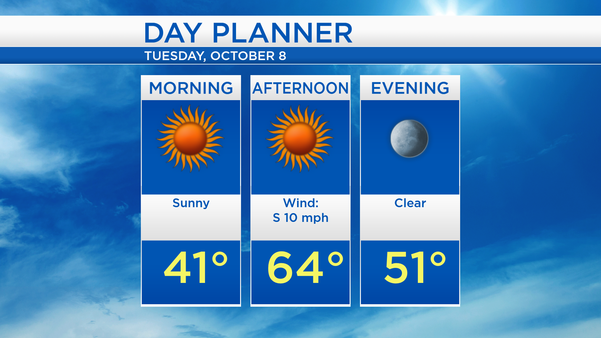
Low temperatures tonight will cool to the upper 30s with clear skies and light winds. High temperatures tomorrow will reach about 64 degrees under sunny skies and a light breeze from the south.
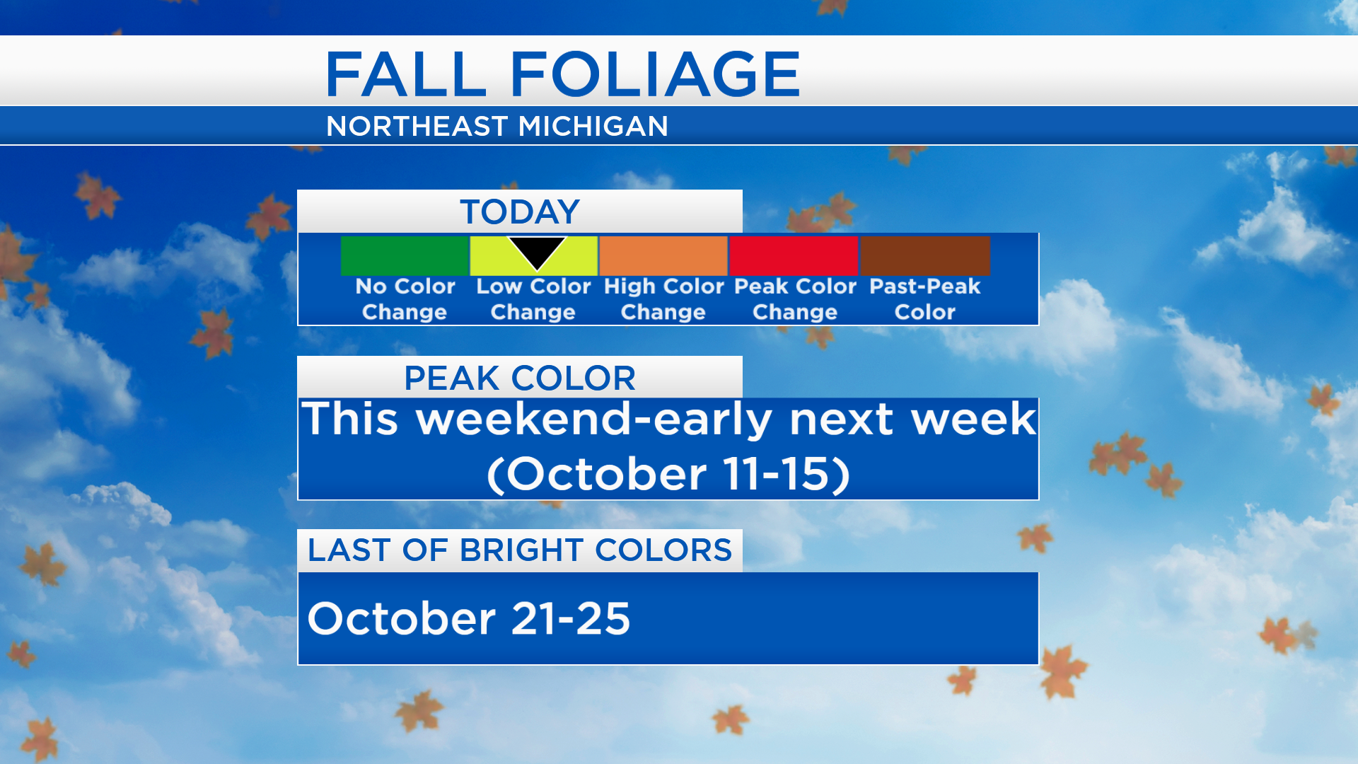
Cool overnight temperatures are contributing to the color changes on the trees throughout Northeast Michigan. Currently, the color change is low to medium, but it will peak in just a few days. The most vibrant color changes usually appear in the middle of October, then become browner as the leaves start to drop near the end of the month.
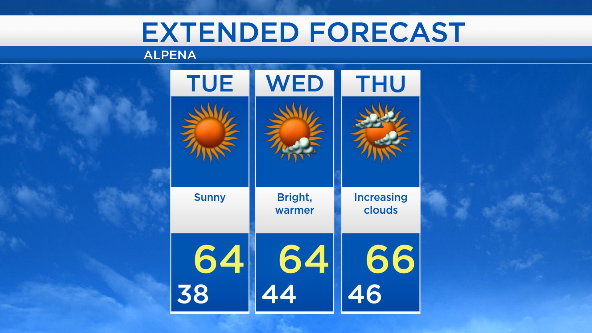
Sunshine will last all day long Tuesday and high temperatures will get up to the middle 60s. Wednesday will start with milder low temperatures in the middle 40s, and it’ll be another day with blue skies and highs in the middle 60s. Cloud cover will increase Thursday afternoon-evening, then rain will arrive Friday afternoon-evening. After the late-week storm system exists, colder air from the north will progress into the Midwest causing temperatures to drop drastically this weekend. For the rest of Northeast Michigan’s weather forecast, watch the latest weather video by clicking the weather tab at the top of the page.