Another cool day tomorrow, warmth returns midweek
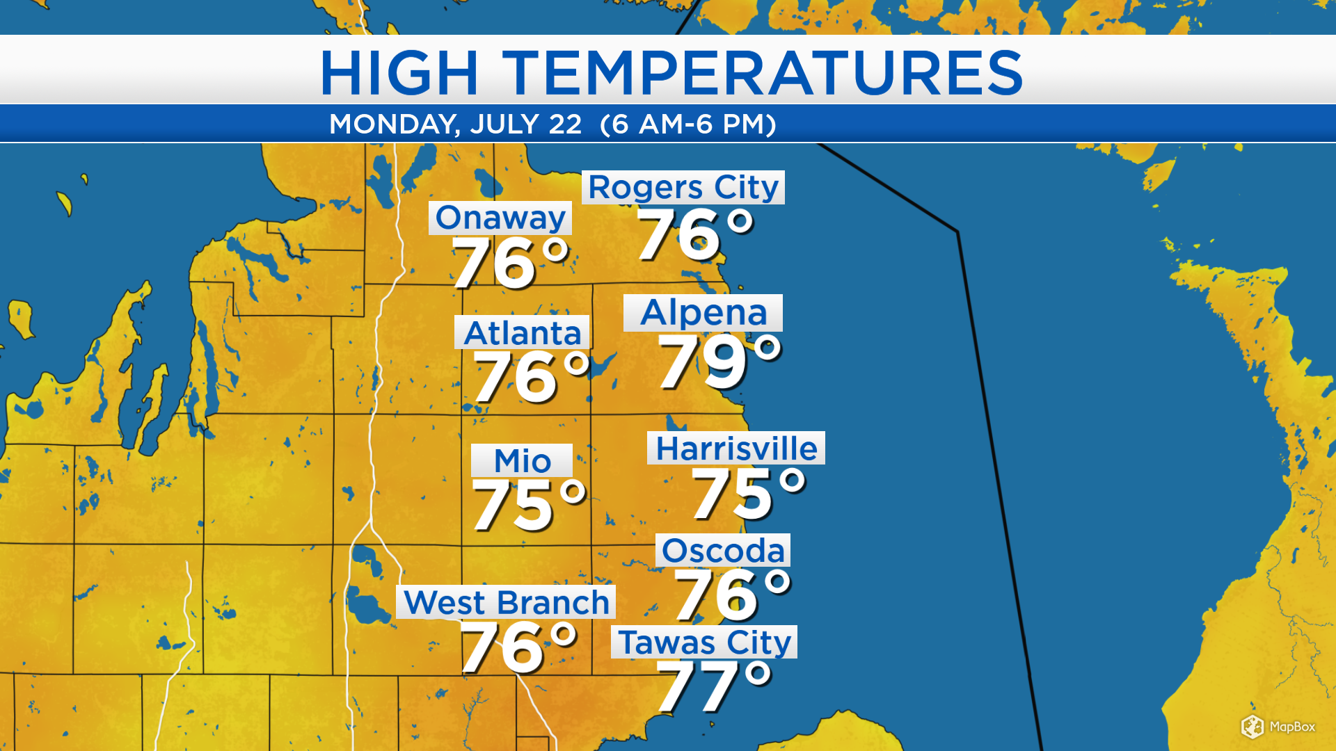
High temperatures today reached the middle to upper 70s across Northeast Michigan, a refreshing change from the end of last week and the weekend. A cold front moved through our area Saturday, providing a breeze out of the northwest — cutting down the heat and humidity. Similar afternoon temperatures are expected tomorrow.
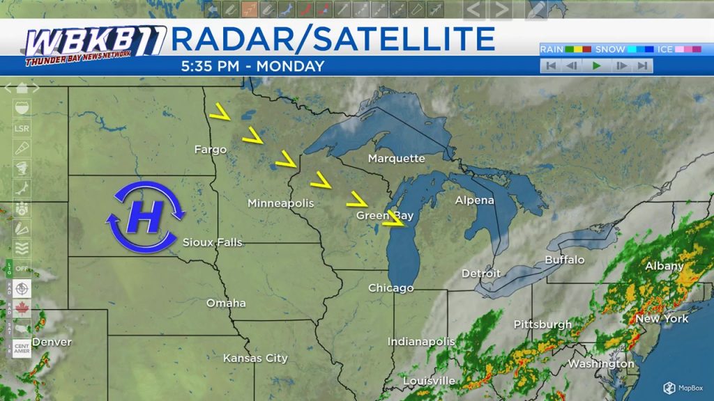
High pressure centered over South Dakota is moving into the Midwest. This area of high pressure located to our west is bringing fair skies and circulating winds out of the northwest. As the area of high pressure travels east, winds will shift out of the southwest later in the week which will bring warmer temperatures to our area.
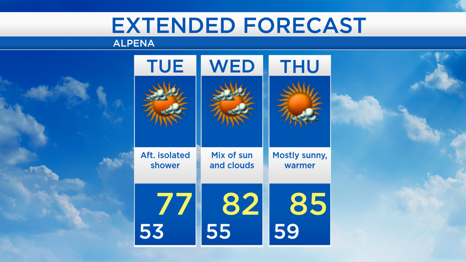
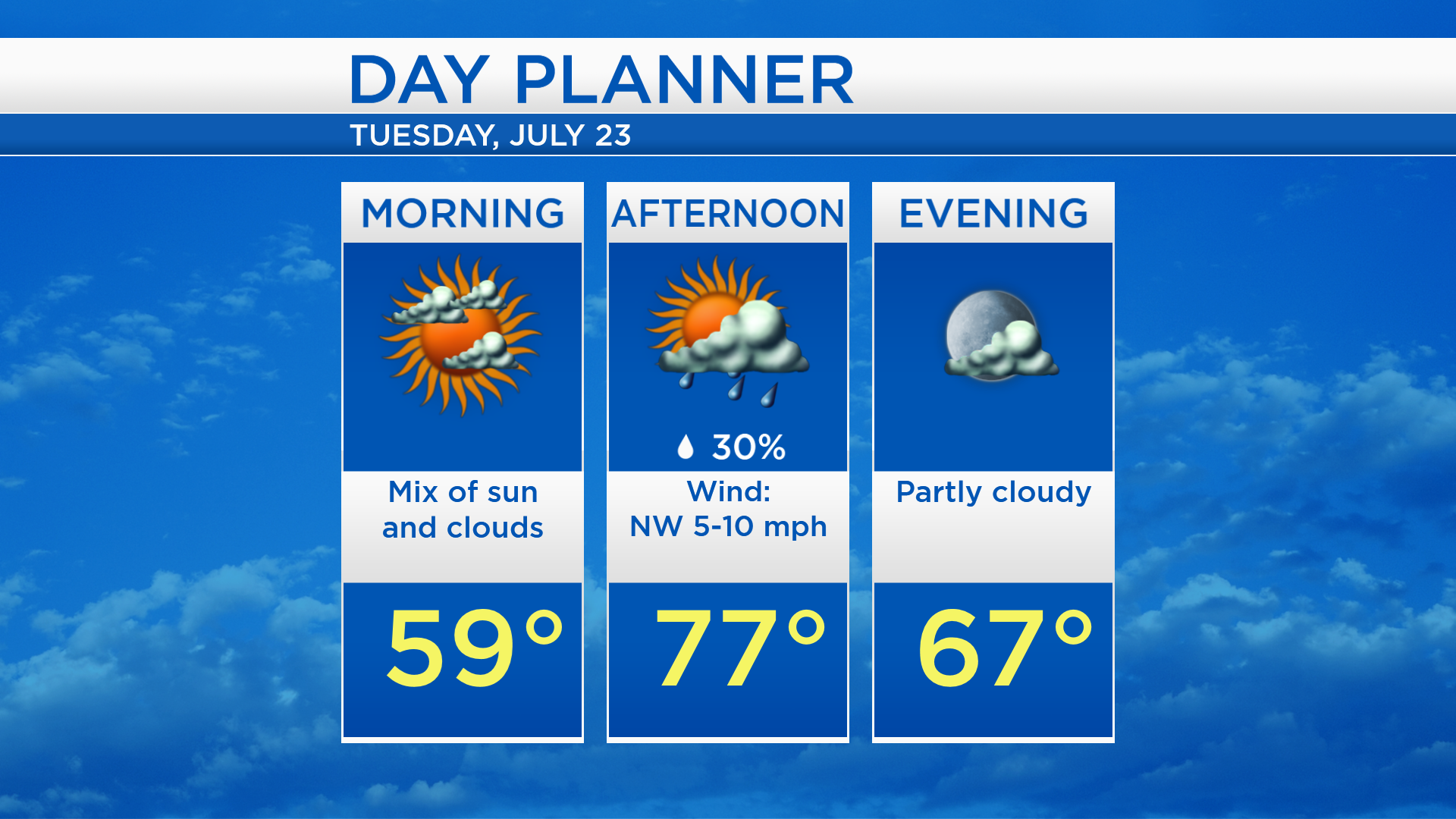
Low temperatures will cool to the lower 50s with clear skies and light winds overnight. We will see partly cloudy skies and a small chance of a shower tomorrow afternoon. High temperatures will reach the upper 70s while light winds continue to come from the northwest.
High temperatures will rise to the lower 80s on Wednesday, then middle 80s on Thursday. Winds out of the southwest will give afternoon temperatures warming to the upper 80s on Friday, Saturday and Sunday.
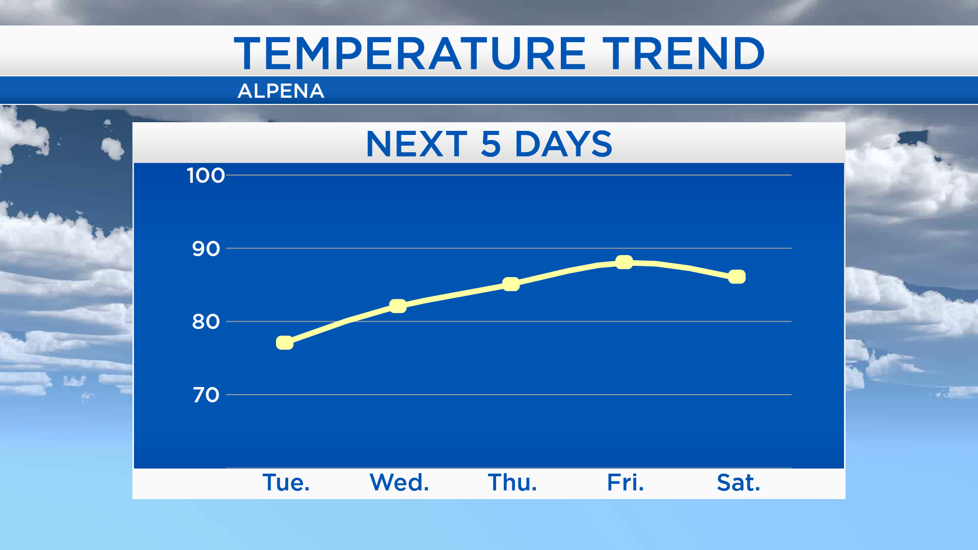
Even though there is a small chance of afternoon showers, Tuesday should end up mostly dry with afternoon temperatures close to 77 degrees. High temperatures will get close to 82 degrees on Wednesday with a mix of sun and clouds. Thursday will be mostly sunny and slightly warmer with high temperatures in the middle 80s. For the rest of Northeast Michigan’s weather forecast, watch the latest weather video by clicking the weather tab at the top of the page.