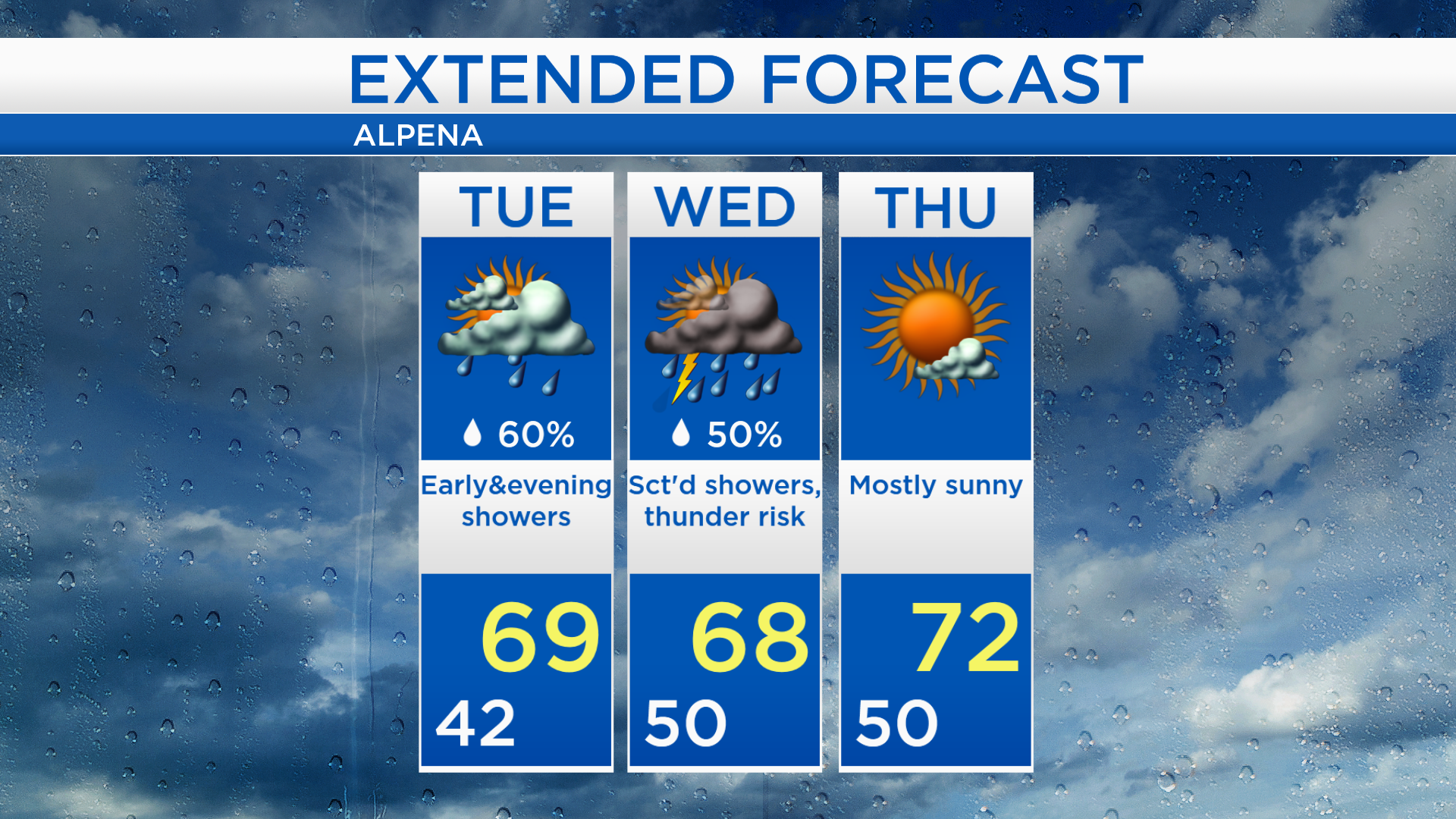
A couple rounds of showers Tuesday and Wednesday; Warmer late-week
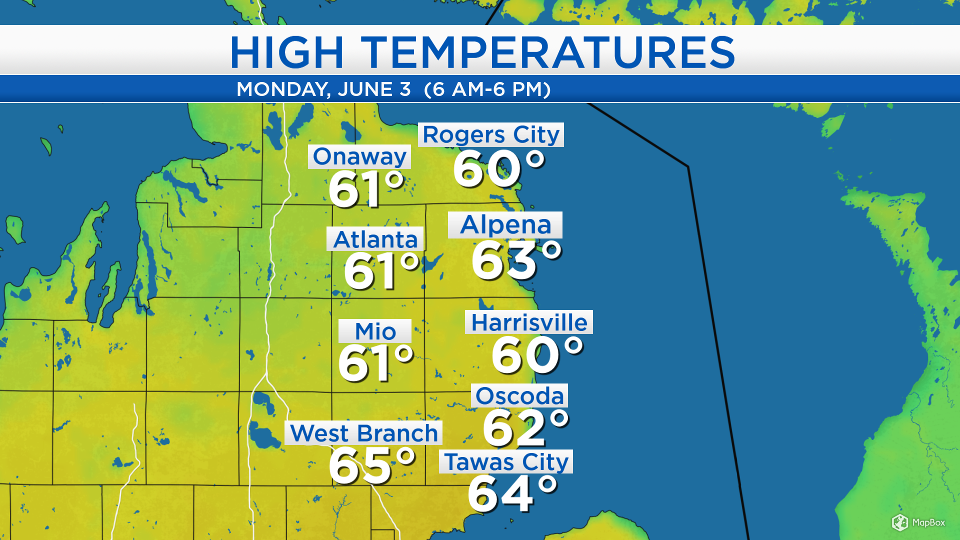
High temperatures today reached the lower 60s in Northeast Michigan. Alpena was warmer than surrounding locations because of a breeze out of the northwest, traveling over the land. In the spring and summer, winds traveling over the land (out of the northwest/west/southwest) produce warmer temperatures toward the shoreline.
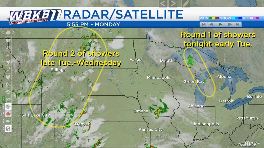
A first round of showers extended south of the Upper Peninsula and into Lake Michigan will move through Northeast Michigan tonight and early tomorrow morning. A large gap of dry weather is expected in the afternoon. The next system currently extending from North Dakota through Montana to Idaho will continue to travel eastbound, and bring our next chance of showers starting tomorrow evening. Then, a few thunderstorms are possible Wednesday midday to afternoon.
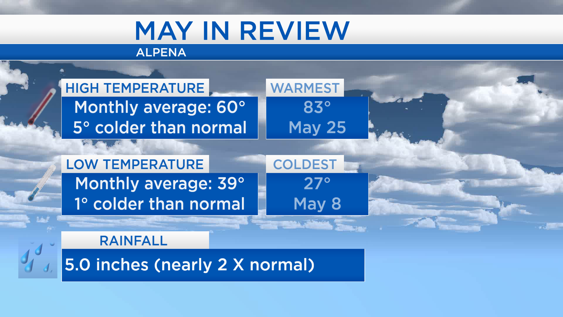
Taking a look back at the month of May, it was colder and wetter than the long-term normal. The average of all the high temperatures measured last month was 60 degrees (5 degrees colder than normal). Low temperatures were closer to normal, all of the low temperatures averaged to 39 degrees, just 1 degree off the normal value. Rainfall totaled 5.0 inches, almost twice the monthly normal.
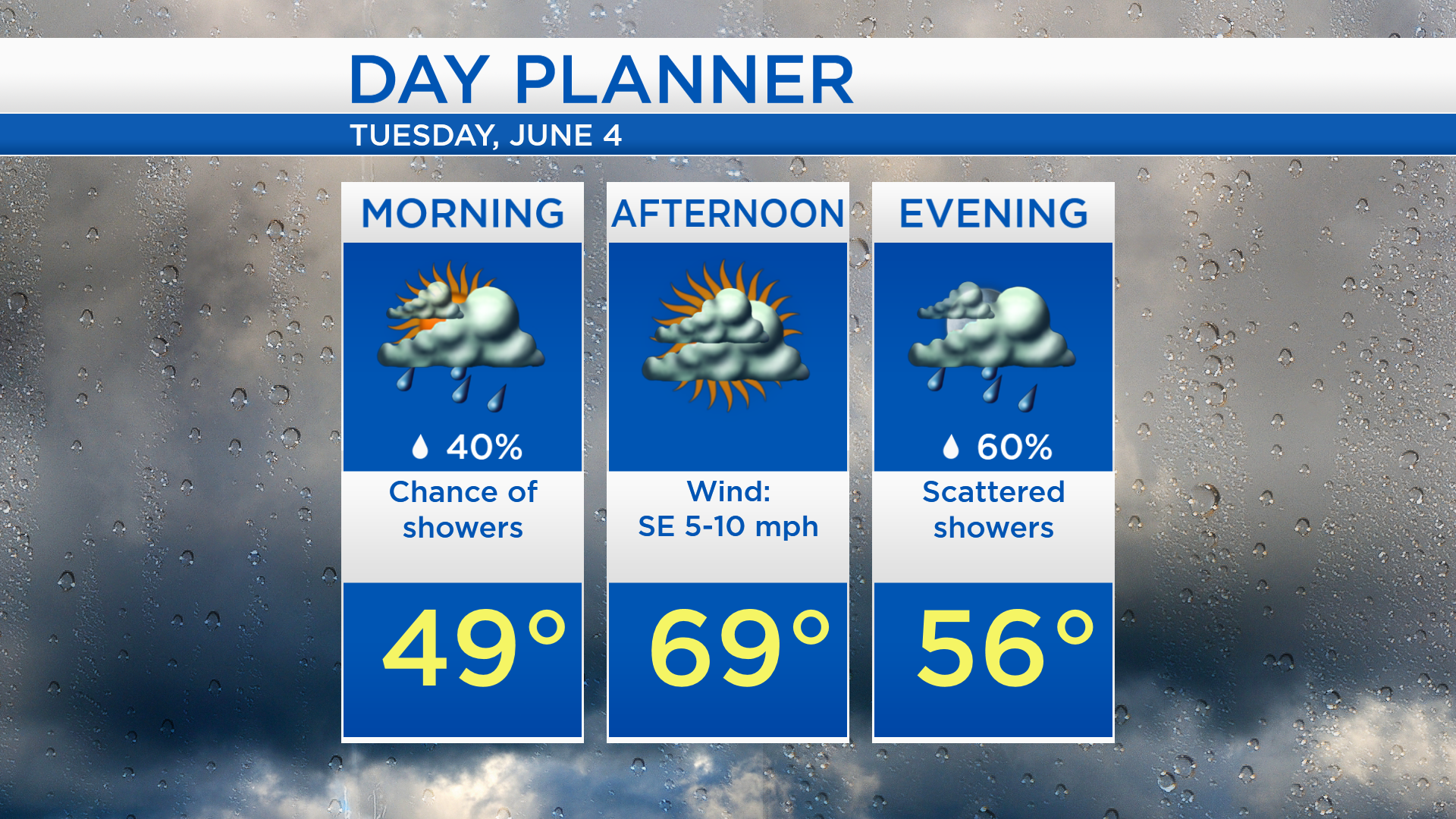
Tomorrow, the greatest chances of showers will occur early in the morning, then during the evening and nighttime. The afternoon should end up mainly dry with high temperatures close to 69 degrees.
High temperatures will reach the upper 60s tomorrow afternoon, then the chance of rain will increase tomorrow evening. Showers are expected on Wednesday, plus a risk of thunderstorms midday-afternoon with highs in the upper 60s. After that, several days of mostly sunny skies are expected from Thursday through the weekend. Afternoon temperatures should warm to the lower 70s on Thursday and Friday. For the rest of Northeast Michigan’s weather forecast, watch the latest weather video by clicking the weather tab at the top of the page.